Vrsac
Airport details
| Country | Serbia |
| State | Vojvodina |
| Region | LY |
| Airspace | Belgrade Ctr |
| Municipality | City of Vršac |
| Elevation | 272ft (83m) |
| Timezone | GMT +1 |
| Coordinates | 45.14771, 21.30974 |
| Magnetic var | |
| Type | land |
| Available since | X-Plane v10.40 |
| ICAO code | LYVR |
| IATA code | n/a |
| FAA code | n/a |
Communication
| Vrsac Tower | 118.600 |
| Vrsac INFO | 123.500 |
| Vrsac Approach | 125.050 |
| Vrsac Approach | 118.600 |
Nearby Points of Interest:
Arcidava
-Grad (Dupljaja)
-Sveti Đurađ monastery
-Deliblato sands
-Teatrul Vechi „Mihai Eminescu”. Muzeul de Istoria Culturii Cărășene
-Labudovo okno
-Steam engine museum in Reșița
-Catholic church in Jaša Tomić
-Cheile Nerei-Beușnița
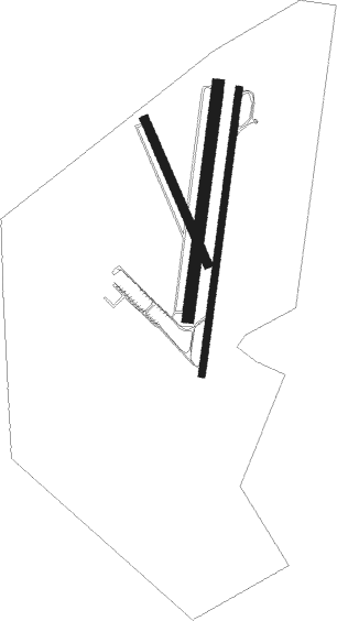
Runway info
Runway 01R / 19L  | ||
| length | 1001m (3284ft) | |
| bearing | 17° / 197° | |
| width | 25m (82ft) | |
| surface | concrete | |
| Runway 01L / 19R | ||
| length | 816m (2677ft) | |
| bearing | 17° / 197° | |
| width | 40m (131ft) | |
| surface | grass | |
| Runway 16 / 34 | ||
| length | 545m (1788ft) | |
| bearing | 154° / 334° | |
| width | 30m (98ft) | |
| surface | grass | |
Nearby beacons
| code | identifier | dist | bearing | frequency |
|---|---|---|---|---|
| VAC | VRSAC VOR/DME | 0.6 | 197° | 115 |
| VRA | VRSAC NDB | 3.6 | 197° | 294 |
| PA | PANCEVO (BELGRADE) NDB | 32.2 | 249° | 495 |
| POZ | POZAREVAC NDB | 32.3 | 197° | 416 |
| CNI | DME | 38.1 | 325° | 115.60 |
| TIM | TRAIAN VUIA (TIMISOARA) NDB | 39.3 | 5° | 338 |
| TSR | TRAIAN VUIA (TIMISOARA) NDB | 40.2 | 360° | 408 |
| TA | TIMISOARA NDB | 41.5 | 354° | 378 |
| JA | BELGRADE NDB | 43 | 244° | 316 |
| EK | BATAJNICA (BELGRADE) NDB | 44.6 | 256° | 420 |
| LGJ | LUGOJ TACAN | 44.8 | 50° | 134 |
| BGD | BELGRADE VOR/DME | 46.7 | 252° | 112.05 |
Departure and arrival routes
| Transition altitude | 10000ft |
| SID end points | distance | outbound heading | |
|---|---|---|---|
| RW01R | |||
| DONI2X | 25mi | 199° | |
| RW19L | |||
| DONI2Y | 25mi | 199° | |
| STAR starting points | distance | inbound heading | |
|---|---|---|---|
| RW01R | |||
| DONI2T, DONI2U, DONI3M | 24.6 | 19° | |
| RW19L | |||
| DONI2T, DONI2U, DONI3M | 24.6 | 19° | |
Holding patterns
| STAR name | hold at | type | turn | heading* | altitude | leg | speed limit |
|---|---|---|---|---|---|---|---|
| DONI2U | VAC | NDB | left | 214 (34)° | > 3000ft | DME 3.7mi | 170 |
| DONI3M | VRA | FIX | left | 192 (12)° | > 2500ft | 1.0min timed | ICAO rules |
| MAVI2A | VRA | FIX | left | 192 (12)° | > 2500ft | 1.0min timed | ICAO rules |
| MAVI2B | VAC | NDB | left | 214 (34)° | > 3000ft | DME 3.7mi | 170 |
| *) magnetic outbound (inbound) holding course | |||||||
Disclaimer
The information on this website is not for real aviation. Use this data with the X-Plane flight simulator only! Data taken with kind consent from X-Plane 12 source code and data files. Content is subject to change without notice.