Senec - Kralova
Airport details
| Country | Slovakia |
| State | Region of Bratislava |
| Region | LZ |
| Airspace | Bratislava Ctr |
| Municipality | Kráľová pri Senci |
| Elevation | 398ft (121m) |
| Timezone | GMT +1 |
| Coordinates | 48.20167, 17.47500 |
| Magnetic var | |
| Type | land |
| Available since | X-Plane v10.40 |
| ICAO code | LZKS |
| IATA code | n/a |
| FAA code | n/a |
Communication
| Kralova INFO | 122.700 |
Nearby Points of Interest:
Orphanage in Modra
-Hrob Ferka Urbánka
-Fakulta architektúry Slovenskej technickej univerzity (budova)
-Polish Institute in Bratislava
-Old building of the Slovak National Theatre
-Embassy of Japan, Bratislava
-Embassy of the United Kingdom, Bratislava
-Braníkov dom
-Spanish Embassy, Bratislava
-Royal Palace of Bratislava Castle
-Joseph-Joachim-Platz 9
-Pfarrkirche Kittsee
-Dunajské luhy Protected Landscape Area
-Szigetközi Tájvédelmi Körzet
-Pfarrkirche Markthof
-Castle Heimenburg, Hainburg an der Donau
-Evang Pfarrkirche
-Kath Pfarrkirche
-City walls of Marchegg
-Pfarrkirche Groißenbrunn
-Evang Pfarrkirche (Zurndorf)
-Karner Bad Deutsch-Altenburg
-Pfarrkirche hll. Peter und Paul, Zurndorf
-Parish church Marchegg
-Jüdischer Friedhof (Gattendorf)
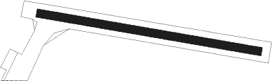
Runway info
| Runway 10 / 28 | ||
| length | 796m (2612ft) | |
| bearing | 100° / 280° | |
| width | 30m (98ft) | |
| surface | grass | |
Nearby beacons
| code | identifier | dist | bearing | frequency |
|---|---|---|---|---|
| JAN | JANOVCE VOR/DME | 3.1 | 108° | 110.80 |
| OKR | STEFANIK NORTH NDB | 7.5 | 277° | 391 |
| OB | STEFANIK SOUTH NDB | 8.7 | 244° | 330 |
| B | BARKA (BRATISLAVA) NDB | 9.7 | 258° | 438 |
| NIT | NITRA VOR/DME | 23.6 | 81° | 116.50 |
| PNY | CENTR (PIESTANY) NDB | 28 | 41° | 297 |
| BRK | BRUCK NDB | 31.5 | 260° | 408 |
| GYR | GYOR VOR/DME | 34 | 155° | 115.10 |
| FMD | FISCHAMEND VOR/DME | 34.3 | 263° | 110.40 |
| WGM | WAGRAM VOR/DME | 40 | 277° | 112.20 |
| CP | PAPA NDB | 47.7 | 180° | 318 |
| C | PAPA NDB | 49.2 | 179° | 493 |
| PCT | PAPA VORTAC | 49.2 | 179° | 114.75 |
| KNE | KUNOVICE NDB | 50.7 | 358° | 434 |
| P | PAPA NDB | 51.4 | 178° | 493 |
| PC | PAPA NDB | 53 | 177° | 318 |
| KUN | KUNOVICE NDB | 54.7 | 2° | 416 |
| B | BOREK (BRNO) NDB | 64.1 | 322° | 429 |
| BNO | BRNO VOR/DME | 64.8 | 320° | 114.45 |
Disclaimer
The information on this website is not for real aviation. Use this data with the X-Plane flight simulator only! Data taken with kind consent from X-Plane 12 source code and data files. Content is subject to change without notice.