Lučenec - Lucenec
Airport details
| Country | Slovakia |
| State | Region of Banská Bystrica |
| Region | |
| Airspace | Bratislava Ctr |
| Municipality | Boľkovce |
| Elevation | 705ft (215m) |
| Timezone | GMT +1 |
| Coordinates | 48.34256, 19.73145 |
| Magnetic var | |
| Type | land |
| Available since | X-Plane v10.40 |
| ICAO code | LZLU |
| IATA code | LUE |
| FAA code | n/a |
Communication
| Lucenec INFO | 122.600 |
Nearby Points of Interest:
Ipolytarnóc Fossils Protected Area
-Lutheran church in Kameňany
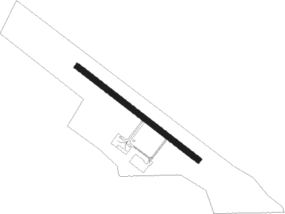
Runway info
| Runway 13 / 31 | ||
| length | 800m (2625ft) | |
| bearing | 121° / 301° | |
| width | 30m (98ft) | |
| surface | asphalt | |
Nearby beacons
| code | identifier | dist | bearing | frequency |
|---|---|---|---|---|
| SLC | SLIAC VOR/DME | 25.4 | 280° | 114 |
| CRT | DME | 33.4 | 1° | 116.75 |
| PW | TATRY WEST NDB | 46.3 | 25° | 418 |
| PPD | TATRY VOR/DME | 49.8 | 41° | 112.10 |
| PPD | TATRY NDB | 50 | 41° | 317 |
| PE | TATRY EAST NDB | 51.6 | 45° | 438 |
| TPS | TAPIOSAP VOR/DME | 52.2 | 199° | 115.90 |
| BUD | BUDAPEST VOR/DME | 56.9 | 208° | 117.30 |
| NTA | TARG DME | 60.7 | 13° | 115.95 |
| KTN | DME | 65.4 | 44° | 114.10 |
Disclaimer
The information on this website is not for real aviation. Use this data with the X-Plane flight simulator only! Data taken with kind consent from X-Plane 12 source code and data files. Content is subject to change without notice.