Prievidza
Airport details
| Country | Slovakia |
| State | Region of Trenčín |
| Region | LZ |
| Airspace | Bratislava Ctr |
| Municipality | Prievidza |
| Elevation | 853ft (260m) |
| Timezone | GMT +1 |
| Coordinates | 48.76611, 18.58667 |
| Magnetic var | |
| Type | land |
| Available since | X-Plane v10.40 |
| ICAO code | LZPE |
| IATA code | n/a |
| FAA code | n/a |
Communication
| Prievidza TRAFFIC | 124.300 |
Nearby Points of Interest:
Lutheran church in Blatnica
-Kamenná vila
-Kalvaria Povazska Bystrica
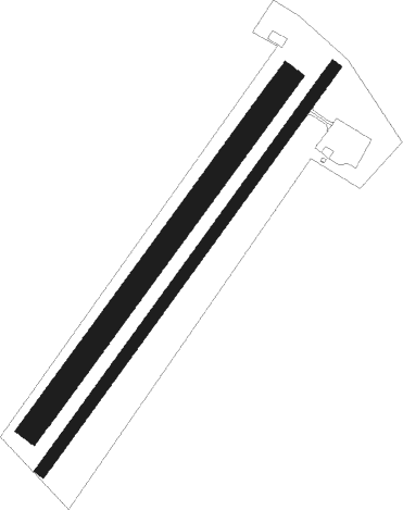
Runway info
Runway 04R / 22L  | ||
| length | 1084m (3556ft) | |
| bearing | 52° / 232° | |
| width | 24m (80ft) | |
| surface | asphalt | |
| displ threshold | 60m (197ft) / 72m (236ft) | |
| Runway 04L / 22R | ||
| length | 947m (3107ft) | |
| bearing | 52° / 232° | |
| width | 52m (171ft) | |
| surface | grass | |
Nearby beacons
| code | identifier | dist | bearing | frequency |
|---|---|---|---|---|
| ZLA | ZILINA NDB | 26.4 | 350° | 404 |
| Z | HLINIK (ZILINA) NDB | 27.7 | 1° | 508 |
| SLC | SLIAC VOR/DME | 28.1 | 121° | 114 |
| PNY | CENTR (PIESTANY) NDB | 31.7 | 258° | 297 |
| NIT | NITRA VOR/DME | 35.6 | 228° | 116.50 |
| R | RADA (OSTRAVA) NDB | 58.2 | 331° | 534 |
| OTA | OSTRAVA VOR/DME | 58.9 | 333° | 117.45 |
| N | NADA (OSTRAVA) NDB | 59.5 | 335° | 258 |
Disclaimer
The information on this website is not for real aviation. Use this data with the X-Plane flight simulator only! Data taken with kind consent from X-Plane 12 source code and data files. Content is subject to change without notice.