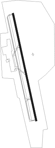
Dickson - Dickson Muni
Airport details
| Country | United States of America |
| State | Tennessee |
| Region | K7 |
| Airspace | Memphis Ctr |
| Municipality | Dickson County |
| Elevation | 892ft (272m) |
| Timezone | GMT -6 |
| Coordinates | 36.12845, -87.43188 |
| Magnetic var | |
| Type | land |
| Available since | X-Plane v10.40 |
| ICAO code | M02 |
| IATA code | n/a |
| FAA code | M02 |
Communication
| Dickson Muni AWOS 3 | 123.875 |
| Dickson Muni CTAF/UNICOM | 122.800 |
Nearby Points of Interest:
Dickson County War Memorial Building
-Montgomery Bell Tunnel
-Mound Bottom
-Greyhound Half-Way House
-Cheatham County Courthouse
-Sanford Wilson House
-Dozier Farm
-Oak Top
-Johnson-Hach House
-Northington-Beach House
-Madison Street Historic District
-Tip Top
-Clarksville Methodist Church
-Belle Vue
-Samuel Rexinger House
-Forbes-Mabry House
-Old Town
-Henry P. Gray House
-Montpier
-Boyd-Wilson Farm
-Meeting-of-the-Waters
-John Motheral House
-West Meade
-William Leaton House
-Madison Street Methodist Church
Nearby beacons
| code | identifier | dist | bearing | frequency |
|---|---|---|---|---|
| GHM | (CENTERVILLE) DME | 17.7 | 184° | 111.60 |
| CK | SNUFF(FT CAMPBELL (CLARKSVILLE NDB | 24 | 6° | 335 |
| CKV | CLARKSVILLE VOR/DME | 29.6 | 2° | 110.60 |
| HXW | SCREAMING EAGLE TACAN | 32.1 | 352° | 114.90 |
| BNA | NASHVILLE VORTAC | 36.2 | 89° | 114.10 |
| FK | AIRBE(FT CAMPBELL/HOPKINSVILLE NDB | 36.5 | 2° | 273 |
| EU | MUREY (MURRAY) NDB | 54.6 | 305° | 368 |
| SYI | SHELBYVILLE VOR/DME | 59.1 | 120° | 113.55 |
| BW | NOORA (BOWLING GREEN) NDB | 64.3 | 52° | 236 |
| BWG | GREEN DME | 67.7 | 51° | 117.90 |
Instrument approach procedures
| runway | airway (heading) | route (dist, bearing) |
|---|---|---|
| RW17 | EKJUP (200°) | EKJUP QUZMU (5mi, 264°) 3000ft |
| RW17 | QUZMU (171°) | QUZMU 3000ft |
| RW17 | UNSEZ (143°) | UNSEZ QUZMU (5mi, 84°) 3000ft |
| RNAV | QUZMU 3000ft URFIG (6mi, 170°) 2500ft M02 (5mi, 172°) 932ft (5281mi, 112°) 1292ft QUZMU (5282mi, 293°) 3000ft QUZMU (turn) |
Disclaimer
The information on this website is not for real aviation. Use this data with the X-Plane flight simulator only! Data taken with kind consent from X-Plane 12 source code and data files. Content is subject to change without notice.