Crystal Springs - Copiah County
Airport details
| Country | United States of America |
| State | Mississippi |
| Region | K7 |
| Airspace | Memphis Ctr |
| Municipality | Copiah County |
| Elevation | 435ft (133m) |
| Timezone | GMT -6 |
| Coordinates | 31.90246, -90.36675 |
| Magnetic var | |
| Type | land |
| Available since | X-Plane v10.40 |
| ICAO code | M11 |
| IATA code | n/a |
| FAA code | n/a |
Communication
| Copiah County CTAF | 122.900 |
Nearby Points of Interest:
Wolfe House
-Mississippi Mills Packing and Shipping Rooms
-Ervin Lewis House
-Hinds County Courthouse
-Porter House
-Dupree-Ratliff House
-Peyton House
-Shelton House
-Lawrence County Courthouse
-Woodrow Wilson Bridge
-Union Church Presbyterian Church
-Smith Park Architectural District
-Jackson City Hall
-Central Fire Station
-Spengler–Thomas Building
-Mississippi Governor's Mansion
-Old Mississippi State Capitol
-Farish Street Neighborhood Historic District
-Mississippi State Capitol
-Joseph Henry Morris House
-Virden-Patton House
-Sims House
-Millsaps-Buie House
-Garner Wynn Green House
-The Cedars
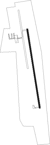
Runway info
| Runway 18 / 36 | ||
| length | 1223m (4012ft) | |
| bearing | 175° / 355° | |
| width | 23m (75ft) | |
| surface | asphalt | |
Nearby beacons
| code | identifier | dist | bearing | frequency |
|---|---|---|---|---|
| JH | BRENZ (JACKSON) NDB | 31.1 | 12° | 260 |
| JA | ALLEN (JACKSON) NDB | 33.1 | 26° | 365 |
| MHZ | MAGNOLIA (MADISON) VORTAC | 34.6 | 27° | 113.20 |
| MCB | MC COMB VORTAC | 36.3 | 170° | 116.70 |
| TKH | TALLULAH (VICKSBURG/TALLULAH) NDB | 39.3 | 297° | 344 |
| MC | FERNI (MCCOMB) NDB | 39.6 | 193° | 413 |
| HAH | NATCHEZ-ADAMS COUNTY NDB | 48.9 | 257° | 388 |
| HEZ | NATCHEZ VOR/DME | 50.6 | 253° | 110 |
Instrument approach procedures
| runway | airway (heading) | route (dist, bearing) |
|---|---|---|
| RW18 | PANTX (174°) | PANTX 6000ft PANTX (turn) 3500ft |
| RNAV | PANTX 3500ft BIOGS (7mi, 174°) 2600ft KOULA (4mi, 174°) 1080ft M11 (2mi, 175°) 483ft (5424mi, 109°) 835ft PANTX (5425mi, 290°) 3500ft PANTX (turn) 3500ft | |
| RW36 | SALOE (355°) | SALOE 6000ft SALOE (turn) 3000ft |
| RNAV | SALOE 3000ft MALMY (7mi, 355°) 2100ft CALAL (3mi, 355°) 1300ft M11 (3mi, 355°) 440ft (5424mi, 109°) 730ft PANTX (5425mi, 290°) 3500ft PANTX (turn) 3500ft |
Disclaimer
The information on this website is not for real aviation. Use this data with the X-Plane flight simulator only! Data taken with kind consent from X-Plane 12 source code and data files. Content is subject to change without notice.