Airports for X-Plane offers a convenient way to explore airports and their related communication information for the X-Plane flight simulator. It only uses data from the X-Plane flight simulator itself, and is therefore more reliable than the data that comes from real aviation websites. You can search for airports by using the ICAO code, or browse for airports per country and state. The information displayed is categorized by airport details, runway information, airport communication, approach frequencies (ILS and Glidepath details), details of nearby beacons, SIDs, STARs and approach procedures.

luggage asphalt railway station stolport train station airliner faa heliport air safety airdock aviation airport authority arrival transit automated airport weather station stol international airport concrete airports runway lighting

Halls - Arnold Field

Airport details

CountryUnited States of America
StateTennessee
RegionK7
AirspaceMemphis Ctr
MunicipalityLauderdale County
Elevation291ft (89m)
TimezoneGMT -6
Coordinates35.90341, -89.39729
Magnetic var
Typeland
Available sinceX-Plane v11.51r1
ICAO codeM31
IATA coden/a
FAA coden/a

Communication

Arnold Field CTAF122.900
Nearby Points of Interest:
Bank of Dyersburg
-
Edward Moody King House
-
Lauderdale County Courthouse
-
Murphy Mound Archeological Site
-
Campbell Archeological Site
-
Kress Building
-
Senter-Rooks House
-
Mississippi County Courthouse
-
Blytheville Greyhound Bus Station
-
West Main Street Residential Historic District
-
Oak Hill Farm
-
Caldwell-Hopson House
-
Bank of Osceola
-
Osceola Times Building
-
Mississippi County Jail
-
City Hall
-
Florida Brothers Building
-
Dickey's Octagonal Barbershop
-
Ross-Sewell House

Runway info

Runway 18 / 36
 length1434m (4705ft)
 bearing178° / 358°
 width23m (75ft)
 surfaceconcrete
 blast zone0m (0ft) / 138m (453ft)

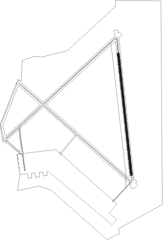
Airport layout


Parking locations

Nearby beacons

codeidentifierdistbearingfrequency
DYRDYERSBURG VORTAC7.935°116.80
MKLMC KELLAR (JACKSON) VOR/DME29.7122°112
UCOBION (UNION CITY) NDB30.646°212
MKLMERSY (JACKSON) NDB31.6131°394
MAWMALDEN VORTAC46.3322°111.20
MEMMEMPHIS VORTAC60.5213°117.50
UUSEYER (CORINTH) NDB65.6139°334

Disclaimer

The information on this website is not for real aviation. Use this data with the X-Plane flight simulator only! Data taken with kind consent from X-Plane 12 source code and data files. Content is subject to change without notice.