Brinkley - Frank Federer Memorial
Airport details
| Country | United States of America |
| State | Arkansas |
| Region | K4 |
| Airspace | Memphis Ctr |
| Municipality | Brinkley |
| Elevation | 193ft (59m) |
| Timezone | GMT -6 |
| Coordinates | 34.88028, -91.17645 |
| Magnetic var | |
| Type | land |
| Available since | X-Plane v10.40 |
| ICAO code | M36 |
| IATA code | n/a |
| FAA code | n/a |
Communication
| Frank Federer Memorial CTAF/UNICOM | 122.800 |
Nearby Points of Interest:
Lick Skillet Railroad Work Station Historic District
-Gazzola and Vaccaro Building
-William Black Family House
-Lo Beele House
-Cache River National Wildlife Refuge
-Orth C. Galloway House
-Moore-Jacobs House
-Bateman-Griffith House
-Jefferies-Crabtree House
-Marston House
-Cumberland Presbyterian Church
-Bondi Brothers Store
-Bank of Clarendon
-Manning, Lee and Moore Law Office
-Merchants and Planters Bank
-Monroe County Bank Building
-Monroe County Courthouse
-Midland Depot
-St. Elizabeth's Catholic Church
-Prairie County Courthouse
-Louisiana Purchase Historic State Park
-De Valls Bluff Waterworks
-Palmer House
-Bedford Brown Bethell House
-Bethel House
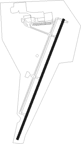
Runway info
| Runway 2 / 20 | ||
| length | 1221m (4006ft) | |
| bearing | 30° / 210° | |
| width | 23m (75ft) | |
| surface | asphalt | |
| displ threshold | 76m (249ft) / 46m (151ft) | |
Nearby beacons
| code | identifier | dist | bearing | frequency |
|---|---|---|---|---|
| TT | STUTT (STUTTGART) NDB | 30.1 | 227° | 338 |
| UJM | MARVELL (HELENA) VOR/DME | 30.8 | 121° | 109.60 |
| DS | CERCY (SEARCY) NDB | 32.2 | 292° | 375 |
| GQE | GILMORE VOR/DME | 44.3 | 56° | 113 |
| LRF | JACKSONVILLE TACAN | 48.3 | 272° | 109.20 |
| PBF | PINE BLUFF VOR/DME | 53.1 | 230° | 116 |
| BV | ALMND (BATESVILLE) NDB | 58 | 323° | 335 |
| JBR | JONESBORO VOR/DME | 66.3 | 31° | 108.60 |
Instrument approach procedures
| runway | airway (heading) | route (dist, bearing) |
|---|---|---|
| RW20 | ICXAV (235°) | ICXAV LEYXO (5mi, 292°) 2800ft |
| RW20 | LEYXO (211°) | LEYXO 8000ft LEYXO (turn) 2800ft |
| RW20 | YOKOJ (182°) | YOKOJ LEYXO (5mi, 112°) 2800ft |
| RNAV | LEYXO 2800ft OMILE (5mi, 211°) 2000ft M36 (6mi, 210°) 235ft (5463mi, 111°) 595ft OZLUR (5468mi, 291°) 2800ft OZLUR (turn) |
Disclaimer
The information on this website is not for real aviation. Use this data with the X-Plane flight simulator only! Data taken with kind consent from X-Plane 12 source code and data files. Content is subject to change without notice.