Alpine County
Airport details
| Country | United States of America |
| State | California |
| Region | K2 |
| Airspace | Oakland Ctr |
| Municipality | Alpine County |
| Elevation | 5867ft (1788m) |
| Timezone | GMT -8 |
| Coordinates | 38.73475, -119.76706 |
| Magnetic var | |
| Type | land |
| Available since | X-Plane v10.32 |
| ICAO code | M45 |
| IATA code | n/a |
| FAA code | n/a |
Communication
Nearby Points of Interest:
Alpine County Courthouse
-Old Webster Schoolhouse
-Ebbetts Pass
-Gardnerville Branch Jail
-Farmer's Bank of Carson Valley
-Carson Valley Improvement Club Hall
-Minden Flour Milling Company
-Minden Wool Warehouse
-Douglas County Courthouse
-Reese-Johnson-Virgin House
-Pope Estate
-De’ek wadapush
-Wabuska Railroad Station
-Virginia and Truckee 27
-Carson City Civic Auditorium
-Ed Z'berg Sugar Pine Point State Park
-Ormsby-Rosser House
-Sears-Ferris House
-William Spence House
-Carson Brewing Company
-Nevada State Printing Office
-Carson City Public Buildings
-Nevada State Capitol
-Rinckel Mansion
Runway info
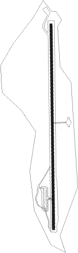
| Runway 17 / 35 | ||
| length | 1361m (4465ft) | |
| bearing | 185° / 5° | |
| width | 15m (50ft) | |
| surface | asphalt | |
Nearby beacons
| code | identifier | dist | bearing | frequency |
|---|---|---|---|---|
| SWR | SQUAW VALLEY(SOUTH LAKE T VOR/DME | 35.5 | 312° | 113.20 |
| HNW | HANGTOWN (PLACERVILLE) VOR/DME | 46 | 269° | 115.50 |
| FMG | MUSTANG (RENO) VORTAC | 48.1 | 8° | 117.90 |
| HZN | HAZEN VORTAC | 59 | 45° | 114.10 |
Disclaimer
The information on this website is not for real aviation. Use this data with the X-Plane flight simulator only! Data taken with kind consent from X-Plane 12 source code and data files. Content is subject to change without notice.