Humboldt - Humboldt Muni
Airport details
| Country | United States of America |
| State | Tennessee |
| Region | K7 |
| Airspace | Memphis Ctr |
| Municipality | Humboldt |
| Elevation | 418ft (127m) |
| Timezone | GMT -6 |
| Coordinates | 35.80219, -88.87495 |
| Magnetic var | |
| Type | land |
| Available since | X-Plane v10.40 |
| ICAO code | M53 |
| IATA code | n/a |
| FAA code | n/a |
Communication
| Humboldt Muni CTAF/UNICOM | 122.800 |
Nearby Points of Interest:
Senter-Rooks House
-Ross-Sewell House
-William Kirby Walsh House
-Carnegie Center for Arts and History
-Chester County Courthouse
-Thompsie Edwards House
-Hamlett-Smith House
-Bank of Dyersburg
-Edward Moody King House
-Allen-White School
-Lauderdale County Courthouse
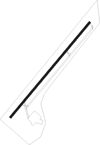
Runway info
| Runway 4 / 22 | ||
| length | 1221m (4006ft) | |
| bearing | 50° / 230° | |
| width | 23m (75ft) | |
| surface | asphalt | |
Nearby beacons
| code | identifier | dist | bearing | frequency |
|---|---|---|---|---|
| MKL | MC KELLAR (JACKSON) VOR/DME | 12 | 190° | 112 |
| MKL | MERSY (JACKSON) NDB | 17.6 | 196° | 394 |
| DYR | DYERSBURG VORTAC | 25.1 | 296° | 116.80 |
| UC | OBION (UNION CITY) NDB | 30.3 | 346° | 212 |
| UU | SEYER (CORINTH) NDB | 48.9 | 162° | 334 |
| EU | MUREY (MURRAY) NDB | 62 | 32° | 368 |
Instrument approach procedures
| runway | airway (heading) | route (dist, bearing) |
|---|---|---|
| RW04 | CAVTO (50°) | CAVTO 3000ft |
| RNAV | CAVTO 3000ft FELIV (6mi, 50°) 2100ft XEFVI (2mi, 50°) 1300ft M53 (3mi, 50°) 457ft (5350mi, 112°) 780ft FASKA (5342mi, 292°) 3000ft FASKA (turn) | |
| RW22 | FASKA (230°) | FASKA 3000ft |
| RNAV | FASKA 3000ft WOKMU (6mi, 230°) 2100ft XITRY (3mi, 230°) 1300ft M53 (3mi, 230°) 472ft (5350mi, 112°) 701ft CAVTO (5358mi, 292°) 3000ft CAVTO (turn) |
Disclaimer
The information on this website is not for real aviation. Use this data with the X-Plane flight simulator only! Data taken with kind consent from X-Plane 12 source code and data files. Content is subject to change without notice.