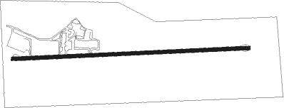
Moscow Mills - Greensfield
Airport details
| Country | United States of America |
| State | Missouri |
| Region | K3 |
| Airspace | Kansas City Ctr |
| Municipality | Lincoln County |
| Elevation | 547ft (167m) |
| Timezone | GMT -6 |
| Coordinates | 38.90178, -90.96030 |
| Magnetic var | |
| Type | land |
| Available since | X-Plane v10.40 |
| ICAO code | M71 |
| IATA code | n/a |
| FAA code | n/a |
Communication
| Greensfield CTAF | 122.900 |
Nearby Points of Interest:
Old Rock House (Moscow Mills, Missouri)
-Downtown Troy Historic District
-Southwestern Bell Repeater Station-Wright City
-Cuivre River State Park Administrative Area Historic District
-Wentzville Tobacco Company Factory
-Ernst Schowengerdt House
-Meier General Store
-St. Paul's Church
-Lock and Dam No. 25
-Daniel Boone Home
-Isaac McCormick House
-High Hill School
-Farmers Mercantile Co. Building
-Augusta Harmonie Verein
-Robert Ewich Farmstead
-Staudinger–Grumke House–Store
-Walnut Street Historic District
-Schudel No. 2 Site
-J. F. Schroer House-Store
-August Sehrt House
-Charles McLee Farris House
-Albert Krog House
-Mindrup House-Store
-John F. Schwegmann House
-Casper Kruse House
Nearby beacons
| code | identifier | dist | bearing | frequency |
|---|---|---|---|---|
| FTZ | FORISTELL VORTAC | 12.4 | 183° | 110.80 |
| SU | SNOOP (ST LOUIS) NDB | 18.1 | 144° | 326 |
| STL | SAINT LOUIS VORTAC | 22.4 | 95° | 117.40 |
| FZ | EAVES (ST LOUIS) NDB | 23.5 | 119° | 227 |
| CSX | DME | 29.4 | 104° | 116.45 |
| CVM | CIVIC MEMORIAL (ALTON) NDB | 42.2 | 91° | 263 |
| CP | ACORE (CAHOKIA/ST LOUIS) NDB | 48 | 113° | 350 |
| VIH | VICHY (ROLLA/VICHY) VOR/DME | 56.9 | 225° | 117.70 |
| UIN | QUINCY VORTAC | 58.7 | 341° | 113.60 |
| UI | QUINCY NDB | 60.7 | 343° | 293 |
| IJX | DME | 62.3 | 40° | 108.60 |
Disclaimer
The information on this website is not for real aviation. Use this data with the X-Plane flight simulator only! Data taken with kind consent from X-Plane 12 source code and data files. Content is subject to change without notice.