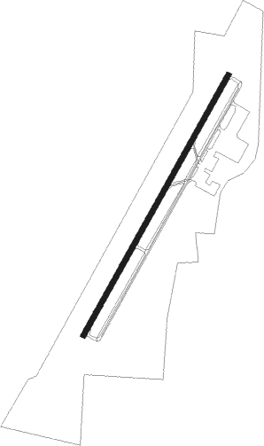
Springfield - Springfield Robertson Co
Airport details
| Country | United States of America |
| State | Tennessee |
| Region | K7 |
| Airspace | Memphis Ctr |
| Municipality | Robertson County |
| Elevation | 707ft (215m) |
| Timezone | GMT -6 |
| Coordinates | 36.53669, -86.92117 |
| Magnetic var | |
| Type | land |
| Available since | X-Plane v10.40 |
| ICAO code | M91 |
| IATA code | n/a |
| FAA code | M91 |
Communication
| Springfield Robertson Co AWOS 3 | 120.675 |
| Springfield Robertson Co CTAF/UNICOM | 123.000 |
| Springfield Robertson Co NASHVILLE Approach/Departure | 119.350 |
Approach frequencies
| LOC | RW04 | 109.7 | 18.00mi |
Nearby Points of Interest:
Mansfield Cheatham House
-Robertson County Courthouse
-Russell House
-Dr. Martin Walton House
-Bell Witch Cave
-Sudley Place
-William Randolph House
-Highland Chapel Union Church
-Madison Street Methodist Church
-Wilkinson House
-Red River Meeting House
-Allensville Historic District
-Cornsilk
-Sanford Wilson House
-Bowen-Campbell House
-Cheatham County Courthouse
-Monthaven
-William Forst House
-Black Bottom Historic District
-Alexander Ewing House
-Brick Church Mound and Village Site
-Frederick Stump House
-McReynolds House
-Franklin Downtown Commercial District
-Simpson County Courthouse
Nearby beacons
| code | identifier | dist | bearing | frequency |
|---|---|---|---|---|
| CK | SNUFF(FT CAMPBELL (CLARKSVILLE NDB | 22.4 | 269° | 335 |
| CKV | CLARKSVILLE VOR/DME | 24.2 | 280° | 110.60 |
| BNA | NASHVILLE VORTAC | 26.5 | 149° | 114.10 |
| FK | AIRBE(FT CAMPBELL/HOPKINSVILLE NDB | 26.6 | 292° | 273 |
| HXW | SCREAMING EAGLE TACAN | 29.3 | 282° | 114.90 |
| BW | NOORA (BOWLING GREEN) NDB | 29.5 | 52° | 236 |
| BWG | GREEN DME | 32.9 | 51° | 117.90 |
| FQW | WALTER HILL (MURFREESBORO) NDB | 43.6 | 136° | 371 |
| GHM | (CENTERVILLE) DME | 49.4 | 217° | 111.60 |
| CCT | CITY DME | 53.3 | 338° | 109.80 |
| SYI | SHELBYVILLE VOR/DME | 63 | 154° | 113.55 |
Instrument approach procedures
| runway | airway (heading) | route (dist, bearing) |
|---|---|---|
| RW04 | INICA (39°) | INICA 3000ft |
| RNAV | INICA 3000ft JOGNA (7mi, 39°) 2500ft NUDXY (3mi, 39°) 1400ft M91 (3mi, 39°) 741ft (5257mi, 113°) 1100ft CODCA (5250mi, 293°) 3000ft CODCA (turn) | |
| RW22 | CODCA (220°) | CODCA 3000ft |
| RNAV | CODCA 3000ft CIRPI (7mi, 220°) 2500ft WEVTO (3mi, 220°) 1560ft M91 (3mi, 220°) 766ft (5257mi, 113°) 956ft INICA (5263mi, 293°) 3000ft INICA (turn) |
Disclaimer
The information on this website is not for real aviation. Use this data with the X-Plane flight simulator only! Data taken with kind consent from X-Plane 12 source code and data files. Content is subject to change without notice.
