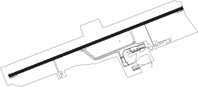
Puerto Plata - Puerto Plata Gregorio Luperon
Airport details
| Country | Dominican Republic |
| State | Puerto Plata |
| Region | MD |
| Airspace | Santo Domingo Ctr |
| Municipality | Sosúa |
| Elevation | 15ft (5m) |
| Timezone | GMT -4 |
| Coordinates | 19.75790, -70.57003 |
| Magnetic var | |
| Type | land |
| Available since | X-Plane v10.40 |
| ICAO code | MDPP |
| IATA code | POP |
| FAA code | n/a |
Communication
| Puerto Plata Gregorio Luperon Ground Control | 121.900 |
| Puerto Plata Gregorio Luperon PUERTO PLATA Tower | 118.000 |
| Puerto Plata Gregorio Luperon PUERTO PLATA Approach | 119.000 |
Nearby beacons
| code | identifier | dist | bearing | frequency |
|---|---|---|---|---|
| PTA | PUERTO PLATA VOR/DME | 0 | 344° | 115.10 |
| SGO | SANTIAGO VOR/DME | 21.1 | 186° | 114.90 |
| DCY | EL CATEY (SAMANA) VOR/DME | 55.3 | 120° | 115.80 |
Departure and arrival routes
| Transition altitude | 17000ft |
| Transition level | 18000ft |
| SID end points | distance | outbound heading | |
|---|---|---|---|
| RW08 | |||
| LERE2C | 39mi | 11° | |
| POKE2C | 38mi | 51° | |
| POKIL1 | 40mi | 109° | |
| KODI2C | 44mi | 145° | |
| RETA2C | 69mi | 291° | |
| MALV2C | 61mi | 309° | |
| RW26 | |||
| LERE2F | 39mi | 11° | |
| POKE2F | 38mi | 51° | |
| KODI2F | 44mi | 145° | |
| RETA2F | 69mi | 291° | |
| MALV2F | 61mi | 309° | |
| STAR starting points | distance | inbound heading | |
|---|---|---|---|
| RW08 | |||
| BEPA2S | 62.4 | 47° | |
| RETA2S | 68.5 | 111° | |
| JUEL2S, JUEL3S | 50.2 | 140° | |
| SEKA3S, SEKA2S | 41.5 | 161° | |
| POKE3S, POKE2S | 38.3 | 231° | |
| RIBE2S | 47.9 | 310° | |
| RW26 | |||
| BEPA2A | 62.4 | 47° | |
| RETA2A | 68.5 | 111° | |
| JUEL2A | 50.2 | 140° | |
| SEKA2A | 41.5 | 161° | |
| POKE2A | 38.3 | 231° | |
| RIBE2A | 47.9 | 310° | |
Instrument approach procedures
| runway | airway (heading) | route (dist, bearing) |
|---|---|---|
| RW08-V | BETOL (135°) | BETOL 4000ft PP380 (10mi, 145°) 4000ft PP381 (5mi, 145°) 2410ft PP382 (4mi, 162°) 1350ft |
| RW08-V | BOLKO (153°) | BOLKO 4000ft PP381 (5mi, 211°) 2410ft PP382 (4mi, 162°) 1350ft |
| RW08-V | DATKI (165°) | DATKI 4000ft PP381 (5mi, 254°) 2410ft PP382 (4mi, 162°) 1350ft |
| RNAV | PP382 1350ft MDPP (5mi, 74°) 67ft PP355 (2mi, 74°) PP356 (3mi, 23°) PP357 (5mi, 329°) EMIVO (17mi, 244°) 4000ft | |
| RW08-Y | PP150 (132°) | PP150 4000ft PP130 (6mi, 142°) 2500ft |
| RW08-Y | XULMI (254°) | XULMI TUGAR (14mi, 270°) 4000ft PP170 (8mi, 270°) 4000ft PP160 (4mi, 270°) 3500ft PP130 (4mi, 240°) 2500ft |
| RNAV | PP130 2500ft DUNIX (3mi, 162°) 2100ft PP120 (1mi, 162°) 1708ft PP110 (3mi, 117°) 703ft PP100 (2mi, 74°) 67ft PP355 (3mi, 74°) XULMI (22mi, 74°) 4000ft XULMI (turn) 4000ft | |
| RW08-Z | BEPAD (74°) | BEPAD 5000ft PP350 (5mi, 74°) 5000ft PP351 (5mi, 74°) 4000ft |
| RW08-Z | EMIVO (89°) | EMIVO 4000ft PP351 (4mi, 162°) 4000ft |
| RNAV | PP351 4000ft KESLO (4mi, 74°) 3000ft 60THR (3mi, 74°) 1980ft 40THR (2mi, 74°) 1350ft 25THR (1mi, 74°) 870ft MDPP (3mi, 74°) 67ft PP355 (2mi, 74°) PP356 (3mi, 23°) PP357 (5mi, 329°) EMIVO (17mi, 244°) 4000ft | |
| RW26-V | KEPDA (160°) | KEPDA 4000ft PP391 (5mi, 74°) 2450ft PP392 (4mi, 162°) 1340ft |
| RW26-V | LETAX (183°) | LETAX 4000ft PP390 (10mi, 169°) 4000ft PP391 (5mi, 169°) 2450ft PP392 (4mi, 162°) 1340ft |
| RNAV | PP392 1340ft MDPP (5mi, 254°) 66ft PP365 (1mi, 254°) PP366 (3mi, 340°) TUGAR (12mi, 71°) 3000ft | |
| RW26 | TUGAR (234°) | TUGAR 3000ft PP360 (4mi, 162°) 2500ft |
| RW26 | VISDI (273°) | VISDI 3000ft PP360 (4mi, 342°) 2500ft |
| RNAV | PP360 2500ft URMIB (4mi, 254°) 2000ft 40TH2 (2mi, 254°) 1340ft 20THR (2mi, 254°) 710ft MDPP (3mi, 254°) 66ft PP365 (1mi, 254°) PP366 (3mi, 340°) TUGAR (12mi, 71°) 3000ft |
Holding patterns
| STAR name | hold at | type | turn | heading* | altitude | leg | speed limit |
|---|---|---|---|---|---|---|---|
| BEPA2A | TUGAR | VHF | left | 354 (174)° | 3000ft - 60000ft | 1.0min timed | 210 |
| BEPA2S | BEPAD | VHF | left | 264 (84)° | 5000ft - 60000ft | 1.0min timed | 210 |
| JUEL2A | TUGAR | VHF | left | 354 (174)° | 3000ft - 60000ft | 1.0min timed | 210 |
| JUEL2S | EMIVO | VHF | right | 354 (174)° | 4000ft - 60000ft | 1.0min timed | 210 |
| POKE2A | TUGAR | VHF | left | 354 (174)° | 3000ft - 60000ft | 1.0min timed | 210 |
| POKE2S | EMIVO | VHF | right | 354 (174)° | 4000ft - 60000ft | 1.0min timed | 210 |
| RETA2A | TUGAR | VHF | left | 354 (174)° | 3000ft - 60000ft | 1.0min timed | 210 |
| RETA2S | EMIVO | VHF | right | 354 (174)° | 4000ft - 60000ft | 1.0min timed | 210 |
| RIBE2A | VISDI | VHF | right | 174 (354)° | 3000ft - 60000ft | 1.0min timed | 210 |
| RIBE2S | EMIVO | VHF | right | 354 (174)° | 4000ft - 60000ft | 1.0min timed | 210 |
| SEKA2A | TUGAR | VHF | left | 354 (174)° | 3000ft - 60000ft | 1.0min timed | 210 |
| SEKA2S | EMIVO | VHF | right | 354 (174)° | 4000ft - 60000ft | 1.0min timed | 210 |
| *) magnetic outbound (inbound) holding course | |||||||
Disclaimer
The information on this website is not for real aviation. Use this data with the X-Plane flight simulator only! Data taken with kind consent from X-Plane 12 source code and data files. Content is subject to change without notice.