Quezaltenango - Quetzaltenango
Airport details
| Country | Guatemala |
| State | Quetzaltenango |
| Region | MG |
| Airspace | Central American Ctr |
| Municipality | Municipio de Quetzaltenango |
| Elevation | 7808ft (2380m) |
| Timezone | GMT -6 |
| Coordinates | 14.86081, -91.50747 |
| Magnetic var | |
| Type | land |
| Available since | X-Plane v10.40 |
| ICAO code | MGQZ |
| IATA code | AAZ |
| FAA code | n/a |
Communication
| Quetzaltenango Tower | 118.600 |
Nearby Points of Interest:
Chichicastenango
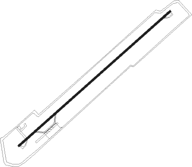
Runway info
| Runway 05 / 23 | ||
| length | 2204m (7231ft) | |
| bearing | 54° / 234° | |
| width | 23m (75ft) | |
| surface | asphalt | |
| displ threshold | 150m (492ft) / 150m (492ft) | |
Nearby beacons
| code | identifier | dist | bearing | frequency |
|---|---|---|---|---|
| TAP | TAPACHULA VOR/DME | 50.5 | 265° | 115.30 |
| AUR | LA AURORA (GUAT. CITY) VOR/DME | 59.2 | 107° | 114.90 |
| SGA | SAN JOSE NDB | 67.1 | 145° | 425 |
| SJO | SAN JOSE (PUERTO SAN JOSE VOR/DME | 68.1 | 144° | 114.10 |
| IZP | IZTAPA NDB | 71.6 | 140° | 400 |
Disclaimer
The information on this website is not for real aviation. Use this data with the X-Plane flight simulator only! Data taken with kind consent from X-Plane 12 source code and data files. Content is subject to change without notice.