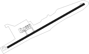
Roatan Island - Roatan/gálvez Intl
Airport details
| Country | Honduras |
| State | Bay Islands |
| Region | MH |
| Airspace | Central American Ctr |
| Municipality | Roatán |
| Elevation | 18ft (5m) |
| Timezone | GMT -6 |
| Coordinates | 16.31728, -86.52229 |
| Magnetic var | |
| Type | land |
| Available since | X-Plane v10.40 |
| ICAO code | MHRO |
| IATA code | RTB |
| FAA code | n/a |
Communication
| Roatan/Gálvez Intl ATIS | 127.850 |
| Roatan/Gálvez Intl Ground Control | 121.600 |
| Roatan/Gálvez Intl ROATAN Tower | 118.100 |
| Roatan/Gálvez Intl ROATAN APCH | 129.000 |
Nearby beacons
| code | identifier | dist | bearing | frequency |
|---|---|---|---|---|
| ROA | ROATAN VOR/DME | 0 | 144° | 117.60 |
| BTO | BONITO VOR/DME | 40 | 210° | 113.50 |
Departure and arrival routes
| Transition altitude | 19500ft |
| Transition level | 20000ft |
| SID end points | distance | outbound heading | |
|---|---|---|---|
| RW07 | |||
| RUBRA1 | 55mi | 239° | |
| KIRAP1 | 77mi | 304° | |
| ANIKO1 | 166mi | 352° | |
| STAR starting points | distance | inbound heading | |
|---|---|---|---|
| RW07 | |||
| RUBRA1 | 55.4 | 59° | |
| KIRAP1 | 76.5 | 124° | |
| LANDA1 | 98.6 | 167° | |
| GABIX1 | 53.7 | 186° | |
Instrument approach procedures
| runway | airway (heading) | route (dist, bearing) |
|---|---|---|
| RW07 | RO003 (66°) | RO003 4000ft RO006 (5mi, 66°) 2300ft |
| RW07 | RO004 (99°) | RO004 4000ft RO006 (5mi, 155°) 2300ft |
| RW07 | RO005 (33°) | RO005 4000ft RO006 (5mi, 335°) 2300ft |
| RNAV | RO006 2300ft RO007 (2mi, 66°) 1660ft MHRO (6mi, 66°) 63ft (5205mi, 101°) 1200ft RO005 (5209mi, 281°) 4000ft |
Disclaimer
The information on this website is not for real aviation. Use this data with the X-Plane flight simulator only! Data taken with kind consent from X-Plane 12 source code and data files. Content is subject to change without notice.
