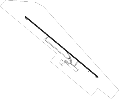
Silao - Guanajuato Intl
Airport details
| Country | Mexico |
| State | Guanajuato |
| Region | MM |
| Airspace | Mexico Ctr |
| Municipality | Silao |
| Elevation | 5956ft (1815m) |
| Timezone | GMT -6 |
| Coordinates | 20.98738, -101.47887 |
| Magnetic var | |
| Type | land |
| Available since | X-Plane v10.40 |
| ICAO code | MMLO |
| IATA code | BJX |
| FAA code | n/a |
Communication
| Guanajuato Intl ATIS | 128.400 |
| Guanajuato Intl LEON Tower | 118.350 |
| Guanajuato Intl LEON Approach | 119.050 |
Nearby beacons
| code | identifier | dist | bearing | frequency |
|---|---|---|---|---|
| BJX | LEON VOR/DME | 0.6 | 340° | 115.80 |
| AGU | AGUASCALIENTES VOR/DME | 64 | 311° | 113.60 |
Departure and arrival routes
| Transition altitude | 18500ft |
| Transition level | 19500ft |
| SID end points | distance | outbound heading | |
|---|---|---|---|
| RW13 | |||
| KARIR1 | 43mi | 38° | |
| UKIR1C | 30mi | 81° | |
| AVRIK3 | 25mi | 105° | |
| URVEM3 | 25mi | 159° | |
| TIDI1C | 30mi | 179° | |
| JAST1C | 57mi | 256° | |
| AGU1C | 64mi | 311° | |
| ANIL1D | 37mi | 326° | |
| RW31 | |||
| MANTA3 | 20mi | 22° | |
| UKIR1D | 30mi | 81° | |
| TIDI1D | 30mi | 179° | |
| JAST1D | 57mi | 256° | |
| NOSUK3 | 25mi | 257° | |
| AMOVA3 | 26mi | 311° | |
| AGU1D | 64mi | 311° | |
| ANIL2E, ANIL3C | 37mi | 326° | |
| HORT1C | 51mi | 357° | |
| STAR starting points | distance | inbound heading | |
|---|---|---|---|
| RW13 | |||
| JAST1E | 56.6 | 76° | |
| AGU1E | 64.0 | 131° | |
| LIBO1A | 40.9 | 203° | |
| MEDA1A | 29.6 | 285° | |
| NAGI1A | 29.4 | 308° | |
| OMIN1C | 35.4 | 339° | |
| RW31 | |||
| JAST1F | 56.6 | 76° | |
| AGU1F | 64.0 | 131° | |
| LIBO1B | 40.9 | 203° | |
| MEDA1B | 29.6 | 285° | |
| NAGI1B | 29.4 | 308° | |
| OMIN1D | 35.4 | 339° | |
Instrument approach procedures
| runway | airway (heading) | route (dist, bearing) |
|---|---|---|
| RW13 | ODGAR (133°) | ODGAR 10200ft LO401 (5mi, 132°) 8600ft |
| RW13 | RIGEP (102°) | RIGEP 10800ft LO401 (7mi, 46°) 8600ft |
| RNAV | LO401 8600ft LO400 (5mi, 132°) 7600ft MMLO (6mi, 134°) 6005ft LO900 (7mi, 131°) TOXOS (15mi, 139°) 10000ft TOXOS (turn) 10000ft | |
| RW31 | ULUMU (346°) | ULUMU 11000ft LO501 (7mi, 46°) 8600ft |
| RW31 | VIRVO (288°) | VIRVO 10200ft LO501 (5mi, 226°) 8600ft |
| RW31 | XESIN (312°) | XESIN 10200ft LO501 (5mi, 312°) 8600ft |
| RNAV | LO501 8600ft LO500 (5mi, 312°) 7600ft MMLO (6mi, 311°) 5949ft LO505 (3mi, 316°) LO804 (7mi, 226°) ULUMU (14mi, 132°) AVREN (12mi, 132°) 12000ft AVREN (turn) 12000ft |
Holding patterns
| STAR name | hold at | type | turn | heading* | altitude | leg | speed limit |
|---|---|---|---|---|---|---|---|
| NAGI1A | TOXOS | VHF | left | 102 (282)° | > 18000ft | 1.0min timed | 230 |
| OMIN1D | AVREN | VHF | left | 172 (352)° | > 12000ft | 1.0min timed | 230 |
| *) magnetic outbound (inbound) holding course | |||||||
Disclaimer
The information on this website is not for real aviation. Use this data with the X-Plane flight simulator only! Data taken with kind consent from X-Plane 12 source code and data files. Content is subject to change without notice.
