Nuevo Laredo - Quetzalcoatl Intl
Airport details
| Country | Mexico |
| State | Tamaulipas |
| Region | MM |
| Airspace | Monterrey Ctr |
| Municipality | Nuevo Laredo |
| Elevation | 482ft (147m) |
| Timezone | GMT -6 |
| Coordinates | 27.45037, -99.57004 |
| Magnetic var | |
| Type | land |
| Available since | X-Plane v10.40 |
| ICAO code | MMNL |
| IATA code | NLD |
| FAA code | n/a |
Communication
| Quetzalcoatl Intl NUEVO LAREDO Approach/Tower | 118.300 |
Approach frequencies
| ILS-cat-I | RW14 | 109.1 | 18.00mi |
| 3° GS | RW14 | 109.1 | 18.00mi |
Nearby Points of Interest:
Laredo Convent Avenue Port of Entry
-San Agustin de Laredo Historic District
-Laredo United States Post Office, Court House and Custom House
-Webb County Courthouse
-Barrio Azteca Historic District
-Trevino-Uribe Rancho
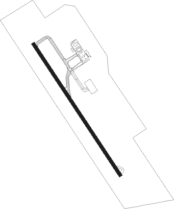
Runway info
| Runway 14 / 32 | ||
| length | 2005m (6578ft) | |
| bearing | 148° / 328° | |
| width | 40m (130ft) | |
| surface | asphalt | |
| blast zone | 56m (184ft) / 61m (200ft) | |
Nearby beacons
| code | identifier | dist | bearing | frequency |
|---|---|---|---|---|
| NLD | NEWLA (NUEVO LAREDO) VOR/DME | 0.7 | 154° | 112.60 |
| LRD | LAREDO VORTAC | 8.2 | 79° | 117.40 |
Departure and arrival routes
| Transition altitude | 18500ft |
| Transition level | 19500ft |
| SID end points | distance | outbound heading | |
|---|---|---|---|
| RW14 | |||
| DUVKA3 | 26mi | 170° | |
| XOVES3 | 26mi | 197° | |
| RUDM1A | 51mi | 197° | |
| SASE1A | 51mi | 215° | |
| ONKA3A | 25mi | 215° | |
| LIPT2A | 25mi | 238° | |
| NOTA3A | 25mi | 255° | |
| ALUX1A | 50mi | 293° | |
| RW32 | |||
| RUDM1B | 51mi | 197° | |
| ONKA2B | 25mi | 215° | |
| SASE1B | 51mi | 215° | |
| LIPT2B | 25mi | 238° | |
| NOTA2B | 25mi | 255° | |
| GAGLO2 | 24mi | 292° | |
| ALUX1B | 50mi | 293° | |
| STAR starting points | distance | inbound heading | |
|---|---|---|---|
| RW14 | |||
| ILIG1A | 50.9 | 1° | |
| RUDM1C | 50.8 | 17° | |
| EMPI1A | 46.3 | 59° | |
| USBA1A | 42.0 | 75° | |
| MATU1A | 51.0 | 350° | |
| RW32 | |||
| ILIG1B | 50.9 | 1° | |
| RUDM1D | 50.8 | 17° | |
| EMPI1B | 46.3 | 59° | |
| USBA1B | 42.0 | 75° | |
| MATU1B | 51.0 | 350° | |
Instrument approach procedures
| runway | airway (heading) | route (dist, bearing) |
|---|---|---|
| RW14 | IRDAN (118°) | IRDAN 4000ft NL401 (5mi, 64°) 2800ft |
| RNAV | NL401 2800ft NL400 (5mi, 148°) 1800ft MMNL (4mi, 145°) 532ft NL800 (3mi, 152°) NL403 (6mi, 244°) NL404 (9mi, 317°) IRDAN (5mi, 8°) 4000ft IRDAN (turn) 7000ft | |
| RW32 | ITREB (20°) | ITREB 4400ft NL501 (5mi, 91°) 2700ft |
| RW32 | VINBO (351°) | VINBO 4400ft NL501 (5mi, 1°) 2700ft |
| RNAV | NL501 2700ft NL500 (5mi, 1°) 1700ft MMNL (5mi, 331°) 525ft NL901 (6mi, 326°) MEKSA (17mi, 219°) 6000ft MEKSA (turn) 6000ft |
Holding patterns
| STAR name | hold at | type | turn | heading* | altitude | leg | speed limit |
|---|---|---|---|---|---|---|---|
| EMPI1A | IRDAN | VHF | left | 238 (58)° | > 4000ft | 1.0min timed | ICAO rules |
| EMPI1B | MEKSA | VHF | left | 259 (79)° | > 6000ft | 1.0min timed | ICAO rules |
| ILIG1A | IRDAN | VHF | left | 238 (58)° | > 4000ft | 1.0min timed | ICAO rules |
| MATU1A | IRDAN | VHF | left | 238 (58)° | > 4000ft | 1.0min timed | ICAO rules |
| RUDM1C | IRDAN | VHF | left | 238 (58)° | > 4000ft | 1.0min timed | ICAO rules |
| USBA1A | IRDAN | VHF | left | 238 (58)° | > 4000ft | 1.0min timed | ICAO rules |
| USBA1B | MEKSA | VHF | left | 259 (79)° | > 6000ft | 1.0min timed | ICAO rules |
| *) magnetic outbound (inbound) holding course | |||||||
Disclaimer
The information on this website is not for real aviation. Use this data with the X-Plane flight simulator only! Data taken with kind consent from X-Plane 12 source code and data files. Content is subject to change without notice.