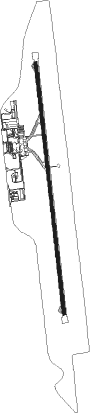
Puebla - Hermanos Serdan Intl
Airport details
| Country | Mexico |
| State | Puebla |
| Region | MM |
| Airspace | Mexico Ctr |
| Municipality | Huejotzingo |
| Elevation | 7359ft (2243m) |
| Timezone | GMT -6 |
| Coordinates | 19.15814, -98.37151 |
| Magnetic var | |
| Type | land |
| Available since | X-Plane v10.40 |
| ICAO code | MMPB |
| IATA code | PBC |
| FAA code | n/a |
Communication
| Hermanos Serdan Intl PUEBLA Approach/Tower | 118.200 |
Nearby Points of Interest:
Biblioteca Palafoxiana
-Our Lady of the Assumption Cathedral
-Parroquia de la Santa Cruz
-former convent of Saint John the Baptist
-Monasteries on the slopes of Popocatépetl
-former convent of Saint Dominic de Guzmán
Runway info
| Runway 17 / 35 | ||
| length | 3625m (11893ft) | |
| bearing | 178° / 358° | |
| width | 45m (148ft) | |
| surface | asphalt | |
Nearby beacons
| code | identifier | dist | bearing | frequency |
|---|---|---|---|---|
| PBC | PUEBLA VOR/DME | 0.1 | 26° | 115.20 |
| APN | APAN VOR/DME | 28.8 | 357° | 114.80 |
| CUA | CUAUTLA VOR/DME | 37.4 | 235° | 116.30 |
| MEX | MEXICO VOR/DME | 42.9 | 292° | 115.90 |
| TPX | TEPEXPAN NDB | 43 | 308° | 359 |
| SLM | SANTA LUCIA VOR/DME | 51.2 | 312° | 116.60 |
| SMO | SAN MATEO VOR/DME | 54 | 295° | 112.10 |
| CVJ | CUERNAVACA VOR/DME | 54.7 | 250° | 113.90 |
| TEQ | TEQUESQUITENGO VOR/DME | 57.9 | 241° | 113.10 |
| PCA | PACHUCA VOR/DME | 61 | 342° | 112.70 |
Departure and arrival routes
| Transition altitude | 18500ft |
| Transition level | 19500ft |
| SID end points | distance | outbound heading | |
|---|---|---|---|
| RW17 | |||
| ATUK1C | 33mi | 11° | |
| NOXO1C | 34mi | 39° | |
| UKUN1C | 26mi | 52° | |
| ILET1C | 21mi | 73° | |
| MAPEN3 | 30mi | 162° | |
| TAKA1C | 29mi | 205° | |
| RW35 | |||
| ATUK1D | 33mi | 11° | |
| NOXO1D | 34mi | 39° | |
| UKUN1D | 26mi | 52° | |
| ALMET2 | 38mi | 57° | |
| ILET1D | 21mi | 73° | |
| TAKA1D | 29mi | 205° | |
| ALITA3 | 29mi | 357° | |
| STAR starting points | distance | inbound heading | |
|---|---|---|---|
| RW17 | |||
| TAKA1A | 29.3 | 25° | |
| ATUK1A | 33.0 | 191° | |
| LARL1C | 26.5 | 355° | |
| RW35 | |||
| TAKA1B | 29.3 | 25° | |
| ATUK1B | 33.0 | 191° | |
| LARL1D | 26.5 | 355° | |
Instrument approach procedures
| runway | airway (heading) | route (dist, bearing) |
|---|---|---|
| RW17 | LERUS (210°) | LERUS 11000ft PB900 (7mi, 268°) 9900ft |
| RW17 | VINGA (190°) | VINGA 11000ft PB900 (7mi, 210°) 9900ft |
| RNAV | PB900 9900ft PB901 (5mi, 178°) 8900ft PBSD1 (2mi, 178°) 8300ft MMPB (4mi, 178°) 7409ft PB800 (11mi, 178°) NAGOS (8mi, 166°) | |
| RW35 | MASEL (326°) | MASEL 11000ft PB800 (7mi, 268°) 9500ft |
| RW35 | PESTA (358°) | PESTA 11000ft PB800 (7mi, 358°) 9500ft |
| RNAV | PB800 9500ft PB801 (5mi, 358°) 8900ft MMPB (6mi, 358°) 7363ft PB810 (10mi, 358°) RETEX (12mi, 25°) 13000ft RETEX (turn) 13000ft |
Holding patterns
| STAR name | hold at | type | turn | heading* | altitude | leg | speed limit |
|---|---|---|---|---|---|---|---|
| ATUK1A | RETEX | VHF | left | 1 (181)° | 17000ft - 60000ft | 1.0min timed | 230 |
| ATUK1B | RETEX | VHF | left | 1 (181)° | 17000ft - 60000ft | 1.0min timed | 230 |
| LARL1C | IMALO | VHF | right | 164 (344)° | 14000ft - 15000ft | 1.0min timed | 230 |
| LARL1D | PESTA | VHF | right | 214 (34)° | 11000ft - 60000ft | 1.0min timed | 230 |
| TAKA1A | IMALO | VHF | right | 164 (344)° | 14000ft - 15000ft | 1.0min timed | 230 |
| TAKA1B | PESTA | VHF | right | 214 (34)° | 11000ft - 60000ft | 1.0min timed | 230 |
| *) magnetic outbound (inbound) holding course | |||||||
Disclaimer
The information on this website is not for real aviation. Use this data with the X-Plane flight simulator only! Data taken with kind consent from X-Plane 12 source code and data files. Content is subject to change without notice.