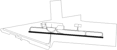
Tijuana - Gral. Abelardo L.rodriguez
Airport details
| Country | Mexico |
| State | Baja California |
| Region | MM |
| Airspace | Mazatlan Ctr |
| Municipality | Tijuana |
| Elevation | 485ft (148m) |
| Timezone | GMT -8 |
| Coordinates | 32.54478, -116.97879 |
| Magnetic var | |
| Type | land |
| Available since | X-Plane v10.40 |
| ICAO code | MMTJ |
| IATA code | TIJ |
| FAA code | n/a |
Communication
| Gral. Abelardo L.Rodriguez info | 132.100 |
| Gral. Abelardo L.Rodriguez tower | 118.100 |
| Gral. Abelardo L.Rodriguez approach | 119.500 |
| Gral. Abelardo L.Rodriguez approach | 120.300 |
Approach frequencies
| ILS-cat-I | RW09 | 111.5 | 18.00mi |
| 3° GS | RW09 | 111.5 | 18.00mi |
Nearby Points of Interest:
United States Custom House
-Tijuana River Estuary
-Granger Hall
-Hubert H. Bancroft Ranch House
-Heilman Villas
-Eagles Hall
-Independent Order of Odd Fellows Building
-San Diego Trust and Savings Bank Building
-Jacob Weinberger United States Courthouse
-San Diego Athletic Club
-Old Police Headquarters
-Ford Building
-El Prado Complex
-California Quadrangle
-Rockwell Field
-Pilot
-Aztec Bowl
-Park Place Methodist Episcopal Church South
-Hepner Hall
-Spruce Street Suspension Bridge
-Naval Air Station North Island
-Mission Brewery
-Marine Corps Recruit Depot San Diego
-Rosecroft
-Naval Training Center San Diego
Nearby beacons
| code | identifier | dist | bearing | frequency |
|---|---|---|---|---|
| TIJ | TIJUANA VOR/DME | 1.3 | 99° | 116.50 |
| PGY | POGGI (SAN DIEGO) VORTAC | 3.9 | 360° | 116.45 |
| NRS | IMPERIAL BEACH TACAN | 6.7 | 278° | 109.20 |
| NZY | NORTH ISLAND (SAN DIEGO) TACAN | 15.2 | 304° | 117 |
| MZB | MISSION BAY (SAN DIEGO) VORTAC | 18.9 | 314° | 117.80 |
| NKX | MIRAMAR (SAN DIEGO) TACAN | 21.4 | 332° | 109.60 |
| JLI | JULIAN VORTAC | 40.8 | 33° | 114 |
| OCN | OCEANSIDE VORTAC | 47.2 | 328° | 115.30 |
| NFG | CAMP PENDLETON (OCEANSIDE TACAN | 48.4 | 331° | 111.80 |
| ENS | ENSENADA NDB | 48.7 | 154° | 400 |
Departure and arrival routes
| Transition altitude | 18500ft |
| Transition level | 19500ft |
| SID end points | distance | outbound heading | |
|---|---|---|---|
| RW09 | |||
| SEVRA4 | 31mi | 87° | |
| ULDU1A | 31mi | 107° | |
| AVEN4A | 31mi | 118° | |
| TEVI1A | 71mi | 118° | |
| OASI4A | 31mi | 127° | |
| TUMA1A | 71mi | 128° | |
| TOPO5A | 31mi | 135° | |
| KOBA1A | 63mi | 135° | |
| KREP1A | 31mi | 153° | |
| RW27 | |||
| ULDU1B | 31mi | 107° | |
| AVEN5B | 31mi | 118° | |
| TEVI2B | 71mi | 118° | |
| OASI5B | 31mi | 127° | |
| TUMA2B | 71mi | 128° | |
| KOBA2B | 63mi | 135° | |
| TOPO5B | 31mi | 135° | |
| KREP1B | 31mi | 153° | |
| STAR starting points | distance | inbound heading | |
|---|---|---|---|
| RW09 | |||
| TANR1A | 71.2 | 287° | |
| TOVE1A | 70.9 | 333° | |
| RW27 | |||
| TANR1B | 71.2 | 287° | |
| TOVE2B | 70.9 | 333° | |
Instrument approach procedures
| runway | airway (heading) | route (dist, bearing) |
|---|---|---|
| RW09 | TUBUS (27°) | TUBUS 4000ft TJ423 (5mi, 319°) 2500ft TJ402 (4mi, 319°) 2500ft TJ414 (5mi, 10°) 2500ft |
| RNAV | TJ414 2500ft TJ415 (3mi, 97°) 2500ft TJ416 (2mi, 98°) 2000ft TJ420 (4mi, 98°) 653ft TUBUS (12mi, 204°) 3000ft TJ455 (7mi, 213°) 3000ft TJ456 (22mi, 129°) KREPE (6mi, 49°) 6000ft KREPE (turn) 6000ft | |
| RW27 | KREPE (333°) | KREPE 8000ft TJ556 (6mi, 335°) TJ563 (5mi, 28°) TJ745 (7mi, 28°) 6000ft TJ557 (5mi, 29°) 5500ft |
| RW27 | ULDUD (287°) | ULDUD 8000ft TJ557 (13mi, 283°) 5500ft |
| RNAV | TJ557 5500ft TJ560 (4mi, 291°) 4200ft TJ410 (2mi, 291°) 3500ft TJ408 (3mi, 291°) 3000ft TJ407 (2mi, 291°) 2500ft TJ406 (3mi, 291°) 1500ft TJ405 (2mi, 291°) 751ft TJ567 (7mi, 263°) TJ455 (16mi, 195°) TJ456 (22mi, 129°) KREPE (6mi, 49°) 6000ft KREPE (turn) 6000ft |
Holding patterns
| STAR name | hold at | type | turn | heading* | altitude | leg | speed limit |
|---|---|---|---|---|---|---|---|
| TANR1A | ULDUD | VHF | right | 99 (279)° | > 11000ft | 1.0min timed | 230 |
| TANR1B | ULDUD | VHF | right | 99 (279)° | > 11000ft | 1.0min timed | 230 |
| TOVE1A | KREPE | VHF | left | 147 (327)° | > 8000ft | 1.0min timed | 230 |
| TOVE2B | KREPE | VHF | left | 147 (327)° | > 8000ft | 1.0min timed | 230 |
| *) magnetic outbound (inbound) holding course | |||||||
Disclaimer
The information on this website is not for real aviation. Use this data with the X-Plane flight simulator only! Data taken with kind consent from X-Plane 12 source code and data files. Content is subject to change without notice.