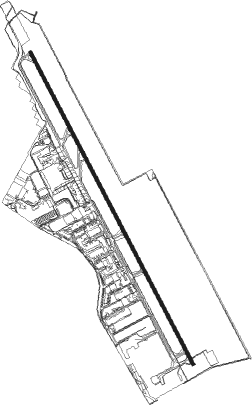
Toluca - Licenciado Adolfo Mateos Intl
Airport details
| Country | Mexico |
| State | State of Mexico |
| Region | MM |
| Airspace | Mexico Ctr |
| Municipality | Toluca |
| Elevation | 8461ft (2579m) |
| Timezone | GMT -6 |
| Coordinates | 19.33130, -99.56606 |
| Magnetic var | |
| Type | land |
| Available since | X-Plane v10.40 |
| ICAO code | MMTO |
| IATA code | TLC |
| FAA code | n/a |
Communication
| Licenciado Adolfo Mateos Intl Toluca ATIS | 127.800 |
| Licenciado Adolfo Mateos Intl Toluca Clearence | 134.100 |
| Licenciado Adolfo Mateos Intl Toluca Ground | 134.000 |
| Licenciado Adolfo Mateos Intl Toluca Tower | 118.000 |
| Licenciado Adolfo Mateos Intl Toluca Approach | 128.900 |
Approach frequencies
| ILS-cat-III | RW15 | 109.5 | 18.00mi |
| 3° GS | RW15 | 109.5 | 18.00mi |
Nearby Points of Interest:
Centro Escolar Revolución
-Xochimilco
-Casa de la Covadonga
-Banco de México Building
-Palacio Legislativo de Donceles
-Former Convent of the Nativity
Nearby beacons
| code | identifier | dist | bearing | frequency |
|---|---|---|---|---|
| TLC | TOLUCA VOR/DME | 0.2 | 73° | 114.30 |
| PTJ | PASTEJE VOR/DME | 23 | 324° | 114.50 |
| SMO | SAN MATEO VOR/DME | 23.3 | 56° | 112.10 |
| MEX | MEXICO VOR/DME | 28.8 | 78° | 115.90 |
| CVJ | CUERNAVACA VOR/DME | 34.7 | 150° | 113.90 |
| TPX | TEPEXPAN NDB | 38.1 | 65° | 359 |
| SLM | SANTA LUCIA VOR/DME | 39.1 | 52° | 116.60 |
| TEQ | TEQUESQUITENGO VOR/DME | 43.1 | 155° | 113.10 |
| CUA | CUAUTLA VOR/DME | 50 | 129° | 116.30 |
| PCA | PACHUCA VOR/DME | 69.2 | 48° | 112.70 |
Departure and arrival routes
| Transition altitude | 18500ft |
| Transition level | 19500ft |
| SID end points | distance | outbound heading | |
|---|---|---|---|
| RW15 | |||
| OMPE1A | 45mi | 43° | |
| PURA1A | 70mi | 86° | |
| TEVO1C | 65mi | 145° | |
| ULEB1C | 38mi | 241° | |
| OVAG1C | 34mi | 255° | |
| SEBO1C | 32mi | 272° | |
| RW33 | |||
| KEBS1A | 32mi | 98° | |
| TEVO1D | 65mi | 145° | |
| ULEB1D | 38mi | 241° | |
| OVAG1D | 34mi | 255° | |
| SEBO1D | 32mi | 272° | |
| STAR starting points | distance | inbound heading | |
|---|---|---|---|
| RW15 | |||
| ELIL1A | 36.5 | 39° | |
| ITLA1A | 45.3 | 146° | |
| LENU1A | 60.6 | 246° | |
| RW33 | |||
| ELIL1B | 36.5 | 39° | |
| ITLA1B | 45.3 | 146° | |
| ILAX1A | 38.9 | 238° | |
Instrument approach procedures
| runway | airway (heading) | route (dist, bearing) |
|---|---|---|
| RW15 | GAINY (140°) | GAINY 13000ft TO902 (6mi, 100°) 11700ft |
| RNAV | TO902 11700ft ALOMI (5mi, 156°) 10600ft MMTO (8mi, 157°) 8518ft TO910 (4mi, 154°) TO911 (14mi, 278°) PEPTO (10mi, 292°) 14000ft PEPTO (turn) 14000ft | |
| RW33 | MUSOS (9°) | MUSOS 13000ft TO801 (7mi, 68°) 11100ft |
| RW33 | VERLU (339°) | VERLU 13000ft TO801 (7mi, 346°) 11100ft |
| RNAV | TO801 11100ft TO800 (5mi, 336°) 10000ft MMTO (5mi, 334°) 8518ft TO810 (6mi, 337°) MUSOS (18mi, 178°) 13000ft |
Disclaimer
The information on this website is not for real aviation. Use this data with the X-Plane flight simulator only! Data taken with kind consent from X-Plane 12 source code and data files. Content is subject to change without notice.