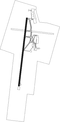
Veracruz - General Heriberto Jara Intl
Airport details
| Country | Mexico |
| State | Veracruz |
| Region | MM |
| Airspace | Mexico Ctr |
| Elevation | 88ft (27m) |
| Timezone | GMT -6 |
| Coordinates | 19.14125, -96.18526 |
| Magnetic var | |
| Type | land |
| Available since | X-Plane v10.40 |
| ICAO code | MMVR |
| IATA code | VER |
| FAA code | n/a |
Communication
| General Heriberto Jara Intl ATIS | 127.800 |
| General Heriberto Jara Intl VERACRUZ Tower | 118.500 |
| General Heriberto Jara Intl VERACRUZ Approach | 120.400 |
| General Heriberto Jara Intl VERACRUZ Departure | 120.400 |
Nearby Points of Interest:
Teatro Francisco Javier Clavijero
Nearby beacons
| code | identifier | dist | bearing | frequency |
|---|---|---|---|---|
| VER | VERACRUZ VOR/DME | 0.2 | 297° | 114 |
Departure and arrival routes
| Transition altitude | 18500ft |
| Transition level | 19500ft |
| SID end points | distance | outbound heading | |
|---|---|---|---|
| RW01 | |||
| LIDAR1 | 50mi | 3° | |
| AMORA1 | 25mi | 3° | |
| BOLTA1 | 25mi | 73° | |
| OMPA1C | 70mi | 74° | |
| GOTA1C | 65mi | 82° | |
| ETNAS1 | 25mi | 82° | |
| NORE1A | 60mi | 96° | |
| AXEL1A | 25mi | 96° | |
| ELOG1C | 59mi | 108° | |
| DUPL1C | 63mi | 123° | |
| ELIK1C | 55mi | 263° | |
| RERA1A | 50mi | 271° | |
| IKLE1C | 50mi | 300° | |
| ONBAD1 | 25mi | 300° | |
| AXORO2 | 25mi | 332° | |
| RW19 | |||
| OMPA1D | 70mi | 74° | |
| GOTA1D | 65mi | 82° | |
| NORE1B | 60mi | 96° | |
| AXEL1B | 25mi | 96° | |
| ELOG1D | 59mi | 108° | |
| IMARA1 | 25mi | 108° | |
| DUPL1D | 63mi | 123° | |
| IPTAK1 | 25mi | 123° | |
| OTILO1 | 25mi | 158° | |
| AVTUX1 | 25mi | 182° | |
| LEXUR1 | 25mi | 195° | |
| ELIK1D | 55mi | 263° | |
| TAMVO1 | 25mi | 263° | |
| RERA1B | 50mi | 271° | |
| URSOT1 | 25mi | 271° | |
| IKLE1D | 50mi | 300° | |
| DURI1C | 50mi | 332° | |
| STAR starting points | distance | inbound heading | |
|---|---|---|---|
| RW01 | |||
| ELIK1A | 55.1 | 83° | |
| TEVE1A | 50.1 | 103° | |
| IKLE1A | 50.2 | 120° | |
| DURI1A | 50.3 | 152° | |
| OMPA1A | 70.3 | 254° | |
| GOTA1A | 64.5 | 262° | |
| ELOG1A | 59.3 | 288° | |
| DUPL1A | 62.5 | 303° | |
| RW19 | |||
| ELIK1B | 55.1 | 83° | |
| TEVE1B | 50.1 | 103° | |
| IKLE1B | 50.2 | 120° | |
| DURI1B | 50.3 | 152° | |
| OMPA1B | 70.3 | 254° | |
| GOTA1B | 64.5 | 262° | |
| ELOG1B | 59.3 | 288° | |
| DUPL1B | 62.5 | 303° | |
Instrument approach procedures
| runway | airway (heading) | route (dist, bearing) |
|---|---|---|
| RW01 | ALRAD (346°) | ALRAD 4000ft VR900 (5mi, 281°) 2500ft |
| RW01 | AMESO (12°) | AMESO 4000ft VR900 (5mi, 12°) 2500ft |
| RW01 | BOBLI (38°) | BOBLI 4000ft VR900 (5mi, 101°) 2500ft |
| RNAV | VR900 2500ft VR901 (5mi, 12°) 1700ft MMVR (6mi, 13°) 139ft VR902 (2mi, 8°) BOBLI (14mi, 213°) 4000ft BOBLI (turn) 4000ft | |
| RW19 | OVUVA (191°) | OVUVA 4000ft VR800 (5mi, 192°) 2500ft |
| RW19 | SUVUL (217°) | SUVUL 4000ft VR800 (5mi, 281°) 2500ft |
| RW19 | VIMRA (164°) | VIMRA 4000ft VR800 (5mi, 101°) 2500ft |
| RNAV | VR800 2500ft VR602 (5mi, 192°) 1700ft MMVR (6mi, 190°) 118ft VR802 (3mi, 195°) SUVUL (14mi, 33°) 4000ft SUVUL (turn) 4000ft |
Disclaimer
The information on this website is not for real aviation. Use this data with the X-Plane flight simulator only! Data taken with kind consent from X-Plane 12 source code and data files. Content is subject to change without notice.