Richland - Richland Muni
Airport details
| Country | United States of America |
| State | Missouri |
| Region | K3 |
| Airspace | Kansas City Ctr |
| Municipality | Pulaski County |
| Elevation | 1109ft (338m) |
| Timezone | GMT -6 |
| Coordinates | 37.87489, -92.40806 |
| Magnetic var | |
| Type | land |
| Available since | X-Plane v10.40 |
| ICAO code | MO1 |
| IATA code | n/a |
| FAA code | MO1 |
Communication
| Richland Muni CTAF | 122.900 |
Nearby Points of Interest:
Calloway Manes Homestead
-Laclede County Jail
-Joe Knight Building
-Maries County Jail and Sheriff's House
-Rolla Ranger Station Historic District
-Phelps County Jail
-Phelps County Courthouse
-National Bank of Rolla Building
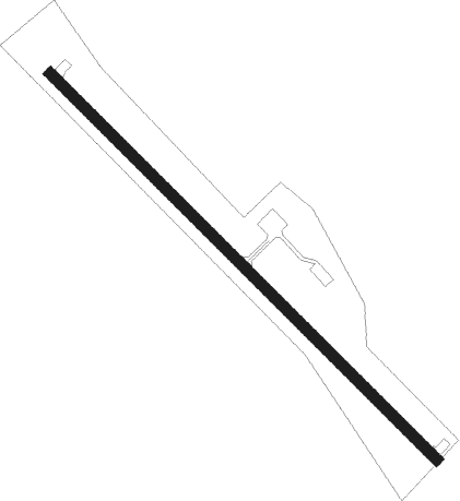
Runway info
| Runway 14 / 32 | ||
| length | 915m (3002ft) | |
| bearing | 133° / 313° | |
| width | 18m (60ft) | |
| surface | asphalt | |
| displ threshold | 52m (171ft) / 40m (131ft) | |
Nearby beacons
| code | identifier | dist | bearing | frequency |
|---|---|---|---|---|
| SHY | SUNSHINE (KAISER) VOR/DME | 13.5 | 310° | 108.40 |
| TBN | FORNEY (FORT LEONARD WOOD VOR | 15 | 116° | 110 |
| BHN | BUCKHORN (FORT LEONARD WOOD) NDB | 17.9 | 120° | 391 |
| MAP | MAPLES TACAN | 34 | 115° | 113.40 |
| VIH | VICHY (ROLLA/VICHY) VOR/DME | 37.1 | 68° | 117.70 |
| JE | ALGOA (JEFFERSON CITY) NDB | 43.4 | 27° | 397 |
| SGF | SPRINGFIELD VORTAC | 53.9 | 241° | 116.90 |
| DGD | DOGWOOD VORTAC | 55.8 | 209° | 109.40 |
| COU | COLUMBIA VOR/DME | 56.9 | 11° | 110.20 |
Disclaimer
The information on this website is not for real aviation. Use this data with the X-Plane flight simulator only! Data taken with kind consent from X-Plane 12 source code and data files. Content is subject to change without notice.