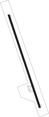
Guantánamo - Mariana Grajales
Airport details
| Country | Cuba |
| State | Guantánamo |
| Region | MU |
| Airspace | Havana Ctr |
| Municipality | Guantanamo |
| Elevation | 56ft (17m) |
| Timezone | GMT -5 |
| Coordinates | 20.08528, -75.15833 |
| Magnetic var | |
| Type | land |
| Available since | X-Plane v10.40 |
| ICAO code | MUGT |
| IATA code | GAO |
| FAA code | n/a |
Communication
| Mariana Grajales GUANTANAMO Tower | 122.600 |
Nearby Points of Interest:
Guantánamo
-El Salvador
-Niceto Pérez
-Archaeological Landscape of the First Coffee Plantations in the South-East of Cuba
Runway info
| Runway 17 / 35 | ||
| length | 2458m (8064ft) | |
| bearing | 165° / 345° | |
| width | 46m (150ft) | |
| surface | asphalt | |
| displ threshold | 48m (157ft) / 255m (837ft) | |
| blast zone | 0m (0ft) / 1m (3ft) | |
Nearby beacons
| code | identifier | dist | bearing | frequency |
|---|---|---|---|---|
| NBW | NAVY GUANTANAMO BAY TACAN | 11 | 199° | 114.60 |
| UCU | SANTIAGO DE CUBA VOR/DME | 38 | 261° | 113.30 |
Instrument approach procedures
| runway | airway (heading) | route (dist, bearing) |
|---|---|---|
| RW17 | GT900 (185°) | GT900 6000ft TALTO (7mi, 237°) 5000ft |
| RW17 | GT901 (145°) | GT901 6000ft TALTO (7mi, 95°) 5000ft |
| RNAV | TALTO 5000ft GT902 (6mi, 165°) 3300ft GT917 (4mi, 165°) 2000ft MUGT (7mi, 165°) 106ft (4569mi, 105°) 1500ft GT903 (4560mi, 285°) 3000ft GT900 (17mi, 331°) 6000ft GT900 (turn) 6000ft |
Disclaimer
The information on this website is not for real aviation. Use this data with the X-Plane flight simulator only! Data taken with kind consent from X-Plane 12 source code and data files. Content is subject to change without notice.
