Santa Clara - Abel Santamaria
Airport details
| Country | Cuba |
| State | Villa Clara |
| Region | MU |
| Airspace | Havana Ctr |
| Municipality | Santa Clara |
| Elevation | 335ft (102m) |
| Timezone | GMT -5 |
| Coordinates | 22.49222, -79.94361 |
| Magnetic var | |
| Type | land |
| Available since | X-Plane v10.30 |
| ICAO code | MUSC |
| IATA code | SNU |
| FAA code | n/a |
Communication
| Abel Santamaria SANTA CLARA Tower | 118.100 |
Nearby Points of Interest:
Historic Centre of Cienfuegos
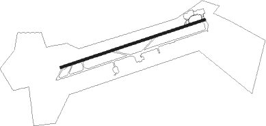
Runway info
| Runway 08 / 26 | ||
| length | 3020m (9908ft) | |
| bearing | 77° / 257° | |
| width | 45m (148ft) | |
| surface | asphalt | |
Nearby beacons
| code | identifier | dist | bearing | frequency |
|---|---|---|---|---|
| UVC | SANTA CLARA VOR/DME | 0.9 | 254° | 117.20 |
| ULV | SANTA CLARA NDB | 1.3 | 257° | 287 |
Departure and arrival routes
| Transition altitude | 3000ft |
| SID end points | distance | outbound heading | |
|---|---|---|---|
| RW08 | |||
| SELOG5, NUBOR4 | 111mi | 37° | |
| DEMSA4 | 81mi | 276° | |
| RW26 | |||
| ISABE6 | 111mi | 37° | |
| IMAKO3 | 109mi | 135° | |
| ETLAS4 | 81mi | 276° | |
| STAR starting points | distance | inbound heading | |
|---|---|---|---|
| RW08 | |||
| POGIS4 | 26.6 | 15° | |
| KIPUS4 | 19.4 | 77° | |
| SILGO4 | 26.5 | 136° | |
| RW26 | |||
| LAZOS1 | 21.4 | 197° | |
| IMASA3 | 22.9 | 257° | |
| FAGUE1 | 23.5 | 306° | |
Instrument approach procedures
| runway | airway (heading) | route (dist, bearing) |
|---|---|---|
| RW08 | SC400 (101°) | SC400 3000ft ONGAS (6mi, 165°) 2000ft |
| RW08 | SC401 (52°) | SC401 3000ft ONGAS (6mi, 345°) 2000ft |
| RNAV | ONGAS 2000ft SC408 (7mi, 77°) 2000ft MUSC (6mi, 77°) 388ft (4848mi, 106°) 1500ft SC410 (4843mi, 286°) SC410 (turn) | |
| RW26 | SC420 (233°) | SC420 3000ft MIVAS (6mi, 165°) 3000ft |
| RW26 | SC421 (280°) | SC421 3000ft MIVAS (6mi, 345°) 3000ft |
| RNAV | MIVAS 3000ft SC426 (7mi, 257°) 2000ft MUSC (6mi, 257°) 368ft (4848mi, 106°) 1500ft SC410 (4843mi, 286°) SC410 (turn) |
Holding patterns
| STAR name | hold at | type | turn | heading* | altitude | leg | speed limit |
|---|---|---|---|---|---|---|---|
| FAGUE1 | FAGUE | VHF | right | 166 (346)° | 4000ft - 14000ft | DME 4.2mi | 230 |
| IMASA3 | IMASA | VHF | right | 83 (263)° | 4000ft - 14000ft | DME 4.2mi | 230 |
| KIPUS4 | KIPUS | VHF | right | 263 (83)° | 4000ft - 14000ft | DME 4.2mi | 230 |
| LAZOS1 | LAZOS | VHF | right | 341 (161)° | 4000ft - 14000ft | DME 4.2mi | 230 |
| POGIS4 | POGIS | VHF | right | 173 (353)° | 5000ft - 14000ft | DME 4.2mi | 230 |
| SILGO4 | SILGO | VHF | right | 353 (173)° | 4000ft - 14000ft | DME 4.2mi | 230 |
| *) magnetic outbound (inbound) holding course | |||||||
Disclaimer
The information on this website is not for real aviation. Use this data with the X-Plane flight simulator only! Data taken with kind consent from X-Plane 12 source code and data files. Content is subject to change without notice.