Orange Walk Town - Orange Walk
Airport details
| Country | Belize |
| State | Orange Walk |
| Region | |
| Airspace | Central American Ctr |
| Municipality | Orange Walk District |
| Elevation | 110ft (34m) |
| Timezone | GMT -6 |
| Coordinates | 18.04749, -88.58719 |
| Magnetic var | |
| Type | land |
| Available since | X-Plane v10.40 |
| ICAO code | MZTH |
| IATA code | ORZ |
| FAA code | n/a |
Communication
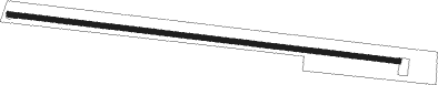
Runway info
| Runway 10 / 28 | ||
| length | 693m (2274ft) | |
| bearing | 101° / 281° | |
| width | 10m (33ft) | |
| surface | asphalt | |
Nearby beacons
| code | identifier | dist | bearing | frequency |
|---|---|---|---|---|
| CTM | CHETUMAL VOR/DME | 31.2 | 29° | 116.30 |
| BZE | BELIZE VOR/DME | 34.2 | 152° | 114.30 |
Disclaimer
The information on this website is not for real aviation. Use this data with the X-Plane flight simulator only! Data taken with kind consent from X-Plane 12 source code and data files. Content is subject to change without notice.