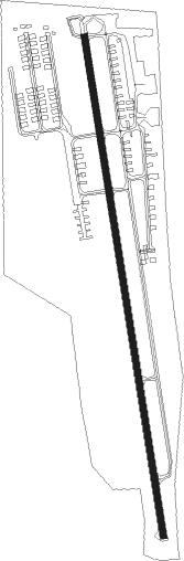
Lincoln Park
Airport details
| Country | United States of America |
| State | New Jersey |
| Region | |
| Airspace | New York Ctr |
| Municipality | Lincoln Park |
| Elevation | 181ft (55m) |
| Timezone | GMT -5 |
| Coordinates | 40.94354, -74.31408 |
| Magnetic var | |
| Type | land |
| Available since | X-Plane v10.40 |
| ICAO code | N07 |
| IATA code | n/a |
| FAA code | N07 |
Communication
| Lincoln Park CTAF/UNICOM | 122.800 |
| Lincoln Park NEW YORK Approach | 127.600 |
Nearby Points of Interest:
Martin Berry House
-Parsonage of the Montville Reformed Dutch Church
-Fairfield Dutch Reformed Church
-Van Riper-Hopper House
-Miller-Kingsland House
-Van Houten-Ackerman House
-Ackerman-Boyd House
-Reaction Motors Rocket Test Facility
-Demarest House
-Ailsa Farms
-Van Blarcom House
-Jacobus Demarest House
-Van Winkle House
-James Dixon Farm
-Rockaway Valley Methodist Church
-Pietro and Maria Botto House
-Patriots' Path
-Stephen Condit House
-Bowlsby-Degelleke House
-Westside Park
-Kossuth Street School
-Canfield-Morgan House
-Van Houten House
-Van Allen House
-De Gray House
Nearby beacons
| code | identifier | dist | bearing | frequency |
|---|---|---|---|---|
| MM | MOREE (MORRISTOWN) NDB | 3.9 | 198° | 392 |
| TE | TORBY (TETERBORO) NDB | 11.7 | 127° | 214 |
| SAX | SPARTA VORTAC | 12.5 | 299° | 115.70 |
| TEB | TETERBORO VOR/DME | 12.7 | 111° | 108.40 |
| CAT | CHATHAM NDB | 13.2 | 210° | 254 |
| LGA | LA GUARDIA (NEW YORK) VOR/DME | 22.3 | 110° | 113.10 |
| BWZ | BROADWAY (SCHOOLEY'S MT) VOR/DME | 24.6 | 254° | 114.20 |
| STW | STILLWATER VOR/DME | 25.3 | 275° | 109.60 |
| CRI | CANARSIE VOR/DME | 27.5 | 128° | 112.30 |
| SBJ | SOLBERG VOR/DME | 29.1 | 230° | 112.90 |
| HUO | HUGUENOT VOR/DME | 30.6 | 329° | 116.10 |
| JFK | KENNEDY (NEW YORK) VOR/DME | 30.9 | 120° | 115.90 |
| SW | NEELY (NEWBURGH) NDB | 32.7 | 9° | 335 |
| SKU | STANWYCK (NEWBURGH) NDB | 37.1 | 25° | 261 |
| COL | COLTS NECK VOR/DME | 38.5 | 166° | 115.40 |
| CMK | CARMEL VOR/DME | 38.8 | 65° | 116.60 |
| FR | FRIKK (FARMINGDALE) NDB | 39 | 101° | 407 |
| RBV | ROBBINSVILLE VORTAC | 45.2 | 194° | 113.80 |
| IGN | KINGSTON VOR/DME | 48.7 | 34° | 117.60 |
| ARD | YARDLEY VOR/DME | 49.5 | 221° | 108.20 |
| NEL | LAKEHURST NDB | 53.9 | 181° | 396 |
| NEL | LAKEHURST TACAN | 54.4 | 182° | 111.80 |
| GXU | MC GUIRE (WRIGHTSTOWN) VORTAC | 57.5 | 197° | 110.60 |
| PWL | PAWLING (POUGHKEEPSIE) VOR/DME | 59.1 | 41° | 114.30 |
| ING | AMBLER NDB | 66.1 | 230° | 275 |
Departure and arrival routes
| STAR starting points | distance | inbound heading | |
|---|---|---|---|
| ALL | |||
| MAZIE3 | 52.0 | 52° | |
Instrument approach procedures
| runway | airway (heading) | route (dist, bearing) |
|---|---|---|
| RW01 | PIYIN (48°) | PIYIN NIYIS (9mi, 86°) 2300ft |
| RNAV | NIYIS 2300ft KIYEG (6mi, 354°) 1700ft CEDDA (3mi, 354°) 631ft (4697mi, 119°) 631ft HALUP (4699mi, 299°) SAX (10mi, 276°) 3000ft SAX (turn) | |
| RW19 | SAX (119°) | SAX ZASEB (9mi, 65°) 2700ft WANVA (5mi, 99°) 2700ft |
| RW19 | WANVA (193°) | WANVA 2700ft |
| RNAV | WANVA 2700ft JAFFE (6mi, 195°) 2200ft ZURGI (4mi, 195°) 415ft (4698mi, 119°) 581ft WANVA (4698mi, 299°) 2700ft WANVA (turn) |
Holding patterns
| STAR name | hold at | type | turn | heading* | altitude | leg | speed limit |
|---|---|---|---|---|---|---|---|
| MAZIE3 | BACKY | VHF | right | 216 (36)° | DME 7.0mi | ICAO rules | |
| MAZIE3 | MAZIE | VHF | left | 237 (57)° | < 17999ft | 1.0min timed | 210 |
| MAZIE3 | RAZER | VHF | right | 229 (49)° | < 60000ft | DME 6.0mi | 210 |
| *) magnetic outbound (inbound) holding course | |||||||
Disclaimer
The information on this website is not for real aviation. Use this data with the X-Plane flight simulator only! Data taken with kind consent from X-Plane 12 source code and data files. Content is subject to change without notice.