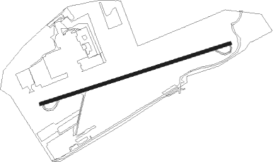
Bloomsburg - Bloomsburg Muni
Airport details
| Country | United States of America |
| State | Pennsylvania |
| Region | K6 |
| Airspace | New York Ctr |
| Municipality | Bloomsburg |
| Elevation | 479ft (146m) |
| Timezone | GMT -5 |
| Coordinates | 40.99765, -76.43525 |
| Magnetic var | |
| Type | land |
| Available since | X-Plane v10.40 |
| ICAO code | N13 |
| IATA code | n/a |
| FAA code | n/a |
Communication
| Bloomsburg Muni CTAF/UNICOM | 122.800 |
| Bloomsburg Muni WILKES BARRE Approach/Departure | 126.300 |
Nearby Points of Interest:
Bloomsburg Historic District
-Catawissa Friends Meetinghouse
-Furnace Covered Bridge No. 11
-Riegel Covered Bridge No. 6
-Welle Hess Covered Bridge No. S1
-Rohrbach Covered Bridge No. 24
-Thomas Beaver Free Library and Danville YMCA
-General William Montgomery House
-Danville Historic District
-Danville West Market Street Historic District
-Jackson Mansion and Carriage House
-Berwick Armory
-Benjamin Evans House
-Bridge in Fishing Creek Township
-Mooresburg School
-St. Paul's Union Church and Cemetery
-Houseknecht Farm
-Bittenbender Covered Bridge
-Lairdsville Covered Bridge
-George W. Search House
-Zion Stone Church
-Sunbury Armory
-Joseph Priestley House
-Hower-Slote House
-Northumberland Historic District
Nearby beacons
| code | identifier | dist | bearing | frequency |
|---|---|---|---|---|
| MIP | MILTON VORTAC | 10.5 | 276° | 109.20 |
| SEG | SELINSGROVE VOR/DME | 23.8 | 245° | 110.40 |
| FQM | WILLIAMSPORT VOR/DME | 25.5 | 315° | 114.40 |
| RAV | RAVINE VORTAC | 27.7 | 200° | 114.60 |
| BZJ | BELLGROVE (INDIANTOWN GAP) NDB | 34.1 | 192° | 328 |
| LVZ | WILKES-BARRE VORTAC | 37.5 | 70° | 111.60 |
| ETX | EAST TEXAS VOR/DME | 42.3 | 119° | 110.20 |
| FJC | ALLENTOWN VORTAC | 47.4 | 105° | 117.50 |
| MD | ENOLA (HARRISBURG) NDB | 49.8 | 212° | 204 |
| HAR | HARRISBURG VORTAC | 50.7 | 222° | 112.50 |
| LRP | LANCASTER VOR/DME | 53.1 | 171° | 117.30 |
| CX | LATLE (HARRISBURG) NDB | 55.6 | 215° | 219 |
| SFK | STONYFORK VOR/DME | 61 | 305° | 108.60 |
| PTW | POTTSTOWN VORTAC | 61.3 | 132° | 116.50 |
Instrument approach procedures
| runway | airway (heading) | route (dist, bearing) |
|---|---|---|
| RWNVB | FQM (135°) | FQM PUNLE (22mi, 166°) 4000ft JEMIP (5mi, 140°) 3200ft |
| RWNVB | MIP (96°) | MIP JEMIP (7mi, 162°) 3200ft JEMIP (turn) 3200ft |
| RWNVB | SEG (65°) | SEG JEMIP (14mi, 65°) 3200ft |
| RNAV | JEMIP 3200ft FOLEV (5mi, 65°) 2500ft GANRE (5mi, 67°) 1560ft (4793mi, 118°) 1560ft MIP (4803mi, 298°) 4000ft MIP (turn) 4000ft |
Disclaimer
The information on this website is not for real aviation. Use this data with the X-Plane flight simulator only! Data taken with kind consent from X-Plane 12 source code and data files. Content is subject to change without notice.