Towanda - Bradford County
Airport details
| Country | United States of America |
| State | Pennsylvania |
| Region | K6 |
| Airspace | New York Ctr |
| Municipality | Bradford County |
| Elevation | 729ft (222m) |
| Timezone | GMT -5 |
| Coordinates | 41.74000, -76.44714 |
| Magnetic var | |
| Type | land |
| Available since | X-Plane v10.40 |
| ICAO code | N27 |
| IATA code | n/a |
| FAA code | n/a |
Communication
| Bradford County CTAF/UNICOM | 123.000 |
| Bradford County BINGHAMTON Approach/Departure | 118.600 |
Nearby Points of Interest:
Bradford County Courthouse
-Towanda Historic District
-Phillip Paul Bliss House
-Ellen and Charles F. Welles House
-Athens Historic District
-Bridge in Athens Township
-Van Dyne Civic Building
-Waverly Village Hall
-Sunbury Historic District
-Nichols High School
-Platt-Cady Mansion
-Worlds End State Park Family Cabin District
-Sullivan County Courthouse
-Tioga Centre General Store
-Old White Mill
-Eagles Mere Historic District
-Christ Episcopal Church
-Chemung District School No. 10
-First Methodist Episcopal Church of Tioga Center
-Vesper Cliff
-Owego Central Historic District
-Tioga County Courthouse
-United States Post Office
-Hiawatha Farm
-James C. Beecher House
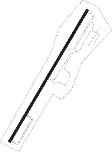
Runway info
| Runway 5 / 23 | ||
| length | 1310m (4298ft) | |
| bearing | 43° / 223° | |
| width | 23m (75ft) | |
| surface | asphalt | |
Nearby beacons
| code | identifier | dist | bearing | frequency |
|---|---|---|---|---|
| FQM | WILLIAMSPORT VOR/DME | 28.2 | 219° | 114.40 |
| CFB | BINGHAMTON VOR/DME | 28.6 | 37° | 112.20 |
| ALP | ALPINE (ELMIRA) NDB | 33.1 | 328° | 245 |
| ULW | ELMIRA VOR/DME | 33.4 | 302° | 109.65 |
| IT | VRNAH (ITHACA) NDB | 41.5 | 7° | 266 |
| SFK | STONYFORK VOR/DME | 43.6 | 267° | 108.60 |
| LVZ | WILKES-BARRE VORTAC | 44.1 | 122° | 111.60 |
| MIP | MILTON VORTAC | 44.1 | 197° | 109.20 |
| ITH | DME | 45.3 | 359° | 111.80 |
| SEG | SELINSGROVE VOR/DME | 60.3 | 205° | 110.40 |
| PYA | PENN YAN NDB | 60.6 | 326° | 260 |
Instrument approach procedures
| runway | airway (heading) | route (dist, bearing) |
|---|---|---|
| RW23 | LACIE (301°) | LACIE DOMVY (19mi, 344°) 4000ft OKZUS (5mi, 286°) 3500ft |
| RW23 | OKZUS (215°) | OKZUS 3500ft |
| RW23 | TIVUC (183°) | TIVUC OKZUS (5mi, 106°) 3500ft |
| RNAV | OKZUS 3500ft DIPGE (3mi, 205°) 2700ft JUNYA (3mi, 205°) 2500ft N27 (6mi, 223°) 751ft (4800mi, 119°) 1800ft OKZUS (4797mi, 299°) 3500ft OKZUS (turn) | |
| RWNVA | FQM (39°) | FQM YULUS (17mi, 37°) 3800ft |
| RNAV | YULUS 3800ft ZEGUK (3mi, 43°) 3300ft N27 (8mi, 43°) 780ft (4800mi, 119°) 1130ft WITAD (4798mi, 299°) OKZUS (6mi, 29°) 3500ft OKZUS (turn) |
Disclaimer
The information on this website is not for real aviation. Use this data with the X-Plane flight simulator only! Data taken with kind consent from X-Plane 12 source code and data files. Content is subject to change without notice.