Honesdale - Cherry Ridge
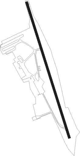
Airport details
| Country | United States of America |
| State | Pennsylvania |
| Region | |
| Airspace | New York Ctr |
| Municipality | Cherry Ridge Township |
| Elevation | 1354ft (413m) |
| Timezone | GMT -5 |
| Coordinates | 41.51956, -75.25280 |
| Magnetic var | |
| Type | land |
| Available since | X-Plane v10.40 |
| ICAO code | N30 |
| IATA code | n/a |
| FAA code | N30 |
Communication
Nearby Points of Interest:
Eugene Dorflinger Estate
-Honesdale Residential Historic District
-J.S. O'Connor American Rich Cut Glassware Factory
-Bellemonte Silk Mill
-Wilmot House
-Wilmot Mansion
-Octagon Stone Schoolhouse
-Lacawac
-Narrowsburg Methodist Church
-Carbondale City Hall and Courthouse
-Spring Glen Synagogue
-Delaware and Hudson Canal Company Office
-Milanville Historic District
-Lord House
-Promised Land State Park Whittaker Lodge District
-Damascus Historic District
-Cochecton Presbyterian Church
-Ellery Calkins House
-Hill's Sawmill
-Parsonage Road Historic District
-Bridge in Dreher Township
-Drake-Curtis House
-Cochecton Center Methodist Episcopal Church
-Old Cochecton Cemetery
-Cochecton
Nearby beacons
| code | identifier | dist | bearing | frequency |
|---|---|---|---|---|
| LVZ | WILKES-BARRE VORTAC | 24.6 | 241° | 111.60 |
| HUO | HUGUENOT VOR/DME | 30.4 | 99° | 116.10 |
| HNK | HANCOCK VOR/DME | 32.7 | 353° | 116.80 |
| STW | STILLWATER VOR/DME | 35.9 | 144° | 109.60 |
| DNY | DE LANCEY VOR/DME | 41.7 | 24° | 112.10 |
| SAX | SPARTA VORTAC | 42.1 | 122° | 115.70 |
| BWZ | BROADWAY (SCHOOLEY'S MT) VOR/DME | 47.4 | 149° | 114.20 |
| FJC | ALLENTOWN VORTAC | 48.4 | 194° | 117.50 |
| CFB | BINGHAMTON VOR/DME | 55 | 306° | 112.20 |
| MM | MOREE (MORRISTOWN) NDB | 56.5 | 125° | 392 |
| RKA | ROCKDALE VOR/DME | 56.8 | 1° | 112.60 |
| ETX | EAST TEXAS VOR/DME | 59.6 | 205° | 110.20 |
| CAT | CHATHAM NDB | 59.7 | 133° | 254 |
| SBJ | SOLBERG VOR/DME | 60.8 | 151° | 112.90 |
Instrument approach procedures
| runway | airway (heading) | route (dist, bearing) |
|---|---|---|
| RWNVB | TALLI (325°) | TALLI 4000ft AYUKU (7mi, 310°) 3500ft |
| RNAV | AYUKU 3500ft WIRAK (6mi, 343°) 2080ft TALLI (13mi, 144°) 4000ft TALLI (turn) |
Disclaimer
The information on this website is not for real aviation. Use this data with the X-Plane flight simulator only! Data taken with kind consent from X-Plane 12 source code and data files. Content is subject to change without notice.