Kutztown
Airport details
| Country | United States of America |
| State | Pennsylvania |
| Region | |
| Airspace | New York Ctr |
| Municipality | Maxatawny Township |
| Elevation | 512ft (156m) |
| Timezone | GMT -5 |
| Coordinates | 40.50653, -75.78768 |
| Magnetic var | |
| Type | land |
| Available since | X-Plane v10.40 |
| ICAO code | N31 |
| IATA code | n/a |
| FAA code | N31 |
Communication
Nearby Points of Interest:
Kutztown 1892 Public School Building
-H.K. Deisher Knitting Mill
-Boyer-Mertz Farm
-Kutz Mill
-Hottenstein Mansion
-Stein Mill
-Merkel Mill Complex
-Christian Schlegel Farm
-First National Bank in Fleetwood
-Sally Ann Furnace Complex
-Siegfried's Dale Farm
-Joel Dreibelbis Farm
-Moselem Farms Mill
-Merkel Mill
-Long-Hawerter Mill
-Guldin Mill
-Hartman Cider Press
-Keim Homestead
-Lenhart Farm
-Mill at Lobachsville
-Mary Ann Furnace Historic District
-Daniel Berk Log House
-Yoder Mill
-Reiff Farm
-Dreibelbis Mill
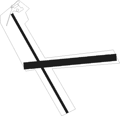
Runway info
Runway 17 / 35  | ||
| length | 750m (2461ft) | |
| bearing | 149° / 329° | |
| width | 15m (50ft) | |
| surface | asphalt | |
| displ threshold | 122m (400ft) / 0m (0ft) | |
| Runway 10 / 28 | ||
| length | 583m (1913ft) | |
| bearing | 89° / 269° | |
| width | 46m (150ft) | |
| surface | grass | |
Nearby beacons
| code | identifier | dist | bearing | frequency |
|---|---|---|---|---|
| ETX | EAST TEXAS VOR/DME | 6.5 | 54° | 110.20 |
| PTW | POTTSTOWN VORTAC | 19.9 | 141° | 116.50 |
| FJC | ALLENTOWN VORTAC | 20.1 | 57° | 117.50 |
| ING | AMBLER NDB | 32.4 | 127° | 275 |
| LRP | LANCASTER VOR/DME | 32.7 | 232° | 117.30 |
| BZJ | BELLGROVE (INDIANTOWN GAP) NDB | 35.2 | 265° | 328 |
| MXE | MODENA VORTAC | 35.7 | 169° | 113.20 |
| RAV | RAVINE VORTAC | 37.1 | 273° | 114.60 |
| ARD | YARDLEY VOR/DME | 43 | 106° | 108.20 |
| LVZ | WILKES-BARRE VORTAC | 46.2 | 7° | 111.60 |
| BWZ | BROADWAY (SCHOOLEY'S MT) VOR/DME | 47.3 | 73° | 114.20 |
| DQO | DUPONT (WILMINGTON) VORTAC | 50.4 | 168° | 114 |
| MIP | MILTON VORTAC | 50.5 | 300° | 109.20 |
| STW | STILLWATER VOR/DME | 51 | 62° | 109.60 |
| IL | HADIN (WILMINGTON) NDB | 56.1 | 169° | 248 |
| OOD | WOODSTOWN VORTAC | 56.8 | 151° | 112.80 |
| FQM | WILLIAMSPORT VOR/DME | 67.1 | 310° | 114.40 |
| VCN | CEDAR LAKE (MILLVILLE) VOR/DME | 69.3 | 140° | 115.20 |
Disclaimer
The information on this website is not for real aviation. Use this data with the X-Plane flight simulator only! Data taken with kind consent from X-Plane 12 source code and data files. Content is subject to change without notice.