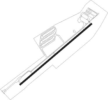
Pittstown - Sky Manor
Airport details
| Country | United States of America |
| State | New Jersey |
| Region | K6 |
| Airspace | New York Ctr |
| Municipality | Alexandria Township |
| Elevation | 560ft (171m) |
| Timezone | GMT -5 |
| Coordinates | 40.56588, -74.97931 |
| Magnetic var | |
| Type | land |
| Available since | X-Plane v10.40 |
| ICAO code | N40 |
| IATA code | n/a |
| FAA code | N40 |
Communication
| Sky Manor ALLENTOWN Approach/Departure | 118.200 |
| Sky Manor CTAF/UNICOM | 122.975 |
| Sky Manor ALLENTOWN Approach/Departure | 124.450 |
Nearby Points of Interest:
Quaker Meeting House
-Old Stone Church
-Rockhill Agricultural Historic District
-Mount Salem Methodist Episcopal Church
-Thatcher House
-Mechlin's Corner Tavern
-Perryville Tavern
-Lansdown
-Fink-Type Truss Bridge
-Uhlerstown–Frenchtown Bridge
-Locktown Baptist Church
-Music Hall
-M. C. Mulligan & Sons Quarry
-Main Street Bridge
-Dunham's Mill
-Old Grandin Library
-Turner-Chew-Carhart Farm
-Clinton Historic District
-Isaac Stover House
-Christoffel Vought Farmstead
-Flemington Historic District
-Flemington
-Dart's Mill Historic District
-Raritan-Readington South Branch Historic District
-John Reading Farmstead
Nearby beacons
| code | identifier | dist | bearing | frequency |
|---|---|---|---|---|
| SBJ | SOLBERG VOR/DME | 10.8 | 86° | 112.90 |
| BWZ | BROADWAY (SCHOOLEY'S MT) VOR/DME | 15.7 | 34° | 114.20 |
| ARD | YARDLEY VOR/DME | 19 | 167° | 108.20 |
| FJC | ALLENTOWN VORTAC | 23.7 | 289° | 117.50 |
| STW | STILLWATER VOR/DME | 26.3 | 14° | 109.60 |
| CAT | CHATHAM NDB | 27.1 | 72° | 254 |
| ING | AMBLER NDB | 29.9 | 215° | 275 |
| RBV | ROBBINSVILLE VORTAC | 31.1 | 127° | 113.80 |
| ETX | EAST TEXAS VOR/DME | 32.1 | 271° | 110.20 |
| PTW | POTTSTOWN VORTAC | 33.6 | 239° | 116.50 |
| MM | MOREE (MORRISTOWN) NDB | 34.8 | 64° | 392 |
| SAX | SPARTA VORTAC | 36.1 | 41° | 115.70 |
| GXU | MC GUIRE (WRIGHTSTOWN) VORTAC | 37.7 | 145° | 110.60 |
| COL | COLTS NECK VOR/DME | 40.4 | 107° | 115.40 |
| TE | TORBY (TETERBORO) NDB | 41.1 | 74° | 214 |
| NEL | LAKEHURST TACAN | 42.7 | 130° | 111.80 |
| NEL | LAKEHURST NDB | 42.9 | 129° | 396 |
| TEB | TETERBORO VOR/DME | 45 | 73° | 108.40 |
| MXE | MODENA VORTAC | 50.1 | 227° | 113.20 |
| CYN | COYLE VORTAC | 51.5 | 144° | 113.40 |
| LVZ | WILKES-BARRE VORTAC | 53.3 | 315° | 111.60 |
| HUO | HUGUENOT VOR/DME | 53.6 | 25° | 116.10 |
| OOD | WOODSTOWN VORTAC | 57.7 | 199° | 112.80 |
| DQO | DUPONT (WILMINGTON) VORTAC | 60.6 | 215° | 114 |
| SW | NEELY (NEWBURGH) NDB | 64.8 | 39° | 335 |
| IL | HADIN (WILMINGTON) NDB | 65.9 | 213° | 248 |
| SKU | STANWYCK (NEWBURGH) NDB | 71.6 | 44° | 261 |
Instrument approach procedures
| runway | airway (heading) | route (dist, bearing) |
|---|---|---|
| RW07 | JILUB (61°) | JILUB 6000ft JILUB (turn) 2500ft |
| RNAV | JILUB 2500ft ZOPDU (5mi, 61°) 1800ft N40 (4mi, 61°) 588ft (4723mi, 118°) 1100ft LIZZI (4732mi, 298°) 3000ft LIZZI (turn) | |
| RW25 | ZIBEK (241°) | ZIBEK 6000ft ZIBEK (turn) 2500ft |
| RNAV | ZIBEK 2500ft GETPE (5mi, 241°) 1900ft N40 (4mi, 241°) 598ft (4723mi, 118°) 1200ft LIZZI (4732mi, 298°) 3000ft LIZZI (turn) |
Disclaimer
The information on this website is not for real aviation. Use this data with the X-Plane flight simulator only! Data taken with kind consent from X-Plane 12 source code and data files. Content is subject to change without notice.