Stowe - Pottstown Muni
Airport details
| Country | United States of America |
| State | Pennsylvania |
| Region | K6 |
| Airspace | New York Ctr |
| Municipality | Pottstown |
| Elevation | 253ft (77m) |
| Timezone | GMT -5 |
| Coordinates | 40.26040, -75.67085 |
| Magnetic var | |
| Type | land |
| Available since | X-Plane v10.40 |
| ICAO code | N47 |
| IATA code | n/a |
| FAA code | n/a |
Communication
| Pottstown Muni CTAF/UNICOM | 122.800 |
| Pottstown Muni CLEARANCE DELIVERY | 118.550 |
| Pottstown Muni PHILADELPHIA | 126.850 |
| Pottstown Muni PHILADELPHIA Approach | 126.850 |
| Pottstown Muni PHILADELPHIA Departure | 126.850 |
Nearby Points of Interest:
Reading Railroad Pottstown Station
-Pottstown Roller Mill
-Old Pottstown Historic District
-Pine Forge Mansion and Industrial Site
-High Street Historic District
-White Horse Tavern
-Grubb Mansion
-George Douglass House
-Old Swede's House
-Sunnybrook (Lower Pottsgrove Township, Pennsylvania)
-Sanatoga Union Sunday School
-Ironstone Bridge
-Weidner Mill
-River Bend Farm
-Bahr Mill Complex
-Rhoads-Lorah House and Barn
-Coventry Hall
-Nathan Michener House
-Stephen Meredith House
-Simon Meredith House
-William and Mordecai Evans House
-Coventryville Historic District
-Parker's Ford
-Philip Rogers House
-Griesemer-Brown Mill Complex
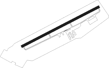
Runway info
| Runway 8 / 26 | ||
| length | 825m (2707ft) | |
| bearing | 72° / 252° | |
| width | 23m (75ft) | |
| surface | asphalt | |
| displ threshold | 116m (381ft) / 0m (0ft) | |
Nearby beacons
| code | identifier | dist | bearing | frequency |
|---|---|---|---|---|
| PTW | POTTSTOWN VORTAC | 5.5 | 109° | 116.50 |
| ETX | EAST TEXAS VOR/DME | 19.2 | 358° | 110.20 |
| ING | AMBLER NDB | 19.4 | 109° | 275 |
| MXE | MODENA VORTAC | 20.5 | 180° | 113.20 |
| FJC | ALLENTOWN VORTAC | 29.6 | 25° | 117.50 |
| LRP | LANCASTER VOR/DME | 29.6 | 257° | 117.30 |
| ARD | YARDLEY VOR/DME | 34.9 | 91° | 108.20 |
| DQO | DUPONT (WILMINGTON) VORTAC | 35 | 174° | 114 |
| IL | HADIN (WILMINGTON) NDB | 40.8 | 175° | 248 |
| OOD | WOODSTOWN VORTAC | 41.1 | 149° | 112.80 |
| BZJ | BELLGROVE (INDIANTOWN GAP) NDB | 41.7 | 281° | 328 |
| RAV | RAVINE VORTAC | 45.9 | 288° | 114.60 |
| SBJ | SOLBERG VOR/DME | 46.6 | 71° | 112.90 |
| BWZ | BROADWAY (SCHOOLEY'S MT) VOR/DME | 50.4 | 58° | 114.20 |
| VCN | CEDAR LAKE (MILLVILLE) VOR/DME | 54.1 | 136° | 115.20 |
| RNB | RAINBOW (MILLVILLE) NDB | 56.2 | 148° | 363 |
| STW | STILLWATER VOR/DME | 57.3 | 47° | 109.60 |
| MIP | MILTON VORTAC | 64.4 | 307° | 109.20 |
| MTN | MARTIN (BALTIMORE) TACAN | 65.4 | 219° | 134.10 |
Instrument approach procedures
| runway | airway (heading) | route (dist, bearing) |
|---|---|---|
| RW26 | PTW (289°) | PTW RUSDE (9mi, 49°) 3000ft RUSDE (turn) 3000ft |
| RW26 | SPUDS (231°) | SPUDS RUSDE (7mi, 176°) 3000ft |
| RW26 | ZUVIV (251°) | ZUVIV RUSDE (6mi, 249°) 3000ft |
| RNAV | RUSDE 3000ft NUGAE (6mi, 252°) 2200ft N47 (6mi, 252°) 274ft (4751mi, 118°) 656ft RUSDE (4741mi, 298°) 3000ft RUSDE (turn) |
Disclaimer
The information on this website is not for real aviation. Use this data with the X-Plane flight simulator only! Data taken with kind consent from X-Plane 12 source code and data files. Content is subject to change without notice.