Whitehouse Station - Solberg Hunterdon
Airport details
| Country | United States of America |
| State | New Jersey |
| Region | K6 |
| Airspace | New York Ctr |
| Municipality | Readington Township |
| Elevation | 193ft (59m) |
| Timezone | GMT -5 |
| Coordinates | 40.58295, -74.73650 |
| Magnetic var | |
| Type | land |
| Available since | X-Plane v10.40 |
| ICAO code | N51 |
| IATA code | n/a |
| FAA code | n/a |
Communication
| Solberg Hunterdon CTAF/UNICOM | 122.800 |
| Solberg Hunterdon New York App/Dep | 132.800 |
Nearby Points of Interest:
Readington Village Historic District
-Charles Eversole House
-Whitehouse-Mechanicsville Historic District
-South Branch Schoolhouse
-North Branch Historic District
-Neshanic Station Lenticular Truss Bridge
-Neshanic Mills
-Lamington Historic District
-Relief Home Company No. 2 Engine House
-Bartles House
-Taylor's Mill Historic District
-General John Frelinghuysen House
-Dart's Mill Historic District
-Old Dutch Parsonage
-Wallace House
-Rockafellows Mill Bridge
-Daniel Robert House
-Oldwick Historic District
-West End Hose Company Number 3
-Jacob Vosseller House
-John Reading Farmstead
-Somerset County Court House complex
-Raritan-Readington South Branch Historic District
-Pluckemin Village Historic District
-Jacobus Vanderveer House
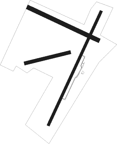
Runway info
Runway 4 / 22  | ||
| length | 1707m (5600ft) | |
| bearing | 37° / 217° | |
| width | 37m (120ft) | |
| surface | asphalt | |
| displ threshold | 396m (1299ft) / 396m (1299ft) | |
| Runway 13 / 31 | ||
| length | 1048m (3438ft) | |
| bearing | 113° / 293° | |
| width | 61m (200ft) | |
| surface | grass | |
| Runway 10 / 28 | ||
| length | 612m (2008ft) | |
| bearing | 83° / 263° | |
| width | 50m (164ft) | |
| surface | grass | |
Nearby beacons
| code | identifier | dist | bearing | frequency |
|---|---|---|---|---|
| SBJ | SOLBERG VOR/DME | 0.2 | 271° | 112.90 |
| BWZ | BROADWAY (SCHOOLEY'S MT) VOR/DME | 13.5 | 338° | 114.20 |
| CAT | CHATHAM NDB | 16.8 | 63° | 254 |
| ARD | YARDLEY VOR/DME | 21.2 | 207° | 108.20 |
| RBV | ROBBINSVILLE VORTAC | 25.3 | 148° | 113.80 |
| MM | MOREE (MORRISTOWN) NDB | 25.5 | 54° | 392 |
| STW | STILLWATER VOR/DME | 25.5 | 342° | 109.60 |
| SAX | SPARTA VORTAC | 30.4 | 22° | 115.70 |
| TE | TORBY (TETERBORO) NDB | 30.5 | 70° | 214 |
| COL | COLTS NECK VOR/DME | 30.9 | 115° | 115.40 |
| FJC | ALLENTOWN VORTAC | 33.8 | 281° | 117.50 |
| TEB | TETERBORO VOR/DME | 34.5 | 68° | 108.40 |
| GXU | MC GUIRE (WRIGHTSTOWN) VORTAC | 35 | 166° | 110.60 |
| NEL | LAKEHURST NDB | 37.1 | 143° | 396 |
| ING | AMBLER NDB | 37.2 | 230° | 275 |
| CRI | CANARSIE VOR/DME | 38.4 | 88° | 112.30 |
| LGA | LA GUARDIA (NEW YORK) VOR/DME | 41.3 | 77° | 113.10 |
| ETX | EAST TEXAS VOR/DME | 43.2 | 270° | 110.20 |
| PTW | POTTSTOWN VORTAC | 43.4 | 246° | 116.50 |
| JFK | KENNEDY (NEW YORK) VOR/DME | 44.1 | 87° | 115.90 |
| CYN | COYLE VORTAC | 48 | 158° | 113.40 |
| HUO | HUGUENOT VOR/DME | 50 | 10° | 116.10 |
| MXE | MODENA VORTAC | 58.5 | 235° | 113.20 |
| SW | NEELY (NEWBURGH) NDB | 58.9 | 29° | 335 |
| LVZ | WILKES-BARRE VORTAC | 59.8 | 306° | 111.60 |
| OOD | WOODSTOWN VORTAC | 62.5 | 211° | 112.80 |
| SKU | STANWYCK (NEWBURGH) NDB | 64.8 | 36° | 261 |
| DQO | DUPONT (WILMINGTON) VORTAC | 67.4 | 224° | 114 |
Departure and arrival routes
| Transition altitude | 18000ft |
| Transition level | 18000ft |
| STAR starting points | distance | inbound heading | |
|---|---|---|---|
| ALL | |||
| LVZ4 | 59.8 | 126° | |
Instrument approach procedures
| runway | airway (heading) | route (dist, bearing) |
|---|---|---|
| RW04 | DIRPE (67°) | DIRPE MOSSE (7mi, 106°) 2600ft |
| RNAV | MOSSE 2600ft PAGED (5mi, 36°) 1800ft N51 (5mi, 35°) 223ft (4713mi, 119°) 1000ft MOSSE (4716mi, 298°) 2600ft MOSSE (turn) | |
| RW22 | DODLY (217°) | DODLY 3000ft |
| RW22 | PIYIN (231°) | PIYIN DODLY (6mi, 249°) 3000ft |
| RNAV | DODLY 3000ft CAVZA (5mi, 217°) 1800ft N51 (5mi, 218°) 202ft MOSSE (10mi, 216°) 2600ft MOSSE (turn) |
Holding patterns
| STAR name | hold at | type | turn | heading* | altitude | leg | speed limit |
|---|---|---|---|---|---|---|---|
| LVZ4 | HARTY | VHF | left | 305 (125)° | 18000ft - 45000ft | 1.5min timed | ICAO rules |
| LVZ4 | HOXIE | VHF | left | 295 (115)° | 18000ft - 45000ft | DME 6.0mi | ICAO rules |
| LVZ4 | MUGZY | VHF | left | 305 (125)° | 6001ft - 14000ft | 1.0min timed | 210 |
| *) magnetic outbound (inbound) holding course | |||||||
Disclaimer
The information on this website is not for real aviation. Use this data with the X-Plane flight simulator only! Data taken with kind consent from X-Plane 12 source code and data files. Content is subject to change without notice.