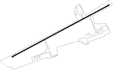
East Stroudsburg - Stroudsburg-pocono
Airport details
| Country | United States of America |
| State | Pennsylvania |
| Region | K6 |
| Airspace | New York Ctr |
| Municipality | Smithfield Township |
| Elevation | 479ft (146m) |
| Timezone | GMT -5 |
| Coordinates | 41.03587, -75.16068 |
| Magnetic var | |
| Type | land |
| Available since | X-Plane v10.40 |
| ICAO code | N53 |
| IATA code | n/a |
| FAA code | N53 |
Communication
| Stroudsburg-Pocono UNICOM | 123.000 |
| Stroudsburg-Pocono ALLENTOWN Approach/Departure | 119.650 |
Nearby beacons
| code | identifier | dist | bearing | frequency |
|---|---|---|---|---|
| STW | STILLWATER VOR/DME | 13.4 | 98° | 109.60 |
| BWZ | BROADWAY (SCHOOLEY'S MT) VOR/DME | 20.9 | 125° | 114.20 |
| FJC | ALLENTOWN VORTAC | 22.8 | 224° | 117.50 |
| LVZ | WILKES-BARRE VORTAC | 27.8 | 294° | 111.60 |
| SAX | SPARTA VORTAC | 28.2 | 87° | 115.70 |
| SBJ | SOLBERG VOR/DME | 33.1 | 137° | 112.90 |
| HUO | HUGUENOT VOR/DME | 34.1 | 57° | 116.10 |
| ETX | EAST TEXAS VOR/DME | 36.2 | 229° | 110.20 |
| CAT | CHATHAM NDB | 37.6 | 112° | 254 |
| MM | MOREE (MORRISTOWN) NDB | 38.6 | 101° | 392 |
| ARD | YARDLEY VOR/DME | 48.3 | 162° | 108.20 |
| SW | NEELY (NEWBURGH) NDB | 50 | 64° | 335 |
| PTW | POTTSTOWN VORTAC | 52.1 | 206° | 116.50 |
| ING | AMBLER NDB | 54.9 | 188° | 275 |
| RBV | ROBBINSVILLE VORTAC | 58.5 | 141° | 113.80 |
| NEL | LAKEHURST NDB | 70.4 | 140° | 396 |
Instrument approach procedures
| runway | airway (heading) | route (dist, bearing) |
|---|---|---|
| RW08 | ZENTI (59°) | ZENTI 3400ft |
| RNAV | ZENTI 3400ft WUSUS (6mi, 44°) 2400ft HAVVI (3mi, 72°) 1580ft N53 (4mi, 72°) 516ft (4736mi, 119°) 2100ft PENNS (4732mi, 299°) 3100ft PENNS (turn) |
Disclaimer
The information on this website is not for real aviation. Use this data with the X-Plane flight simulator only! Data taken with kind consent from X-Plane 12 source code and data files. Content is subject to change without notice.
