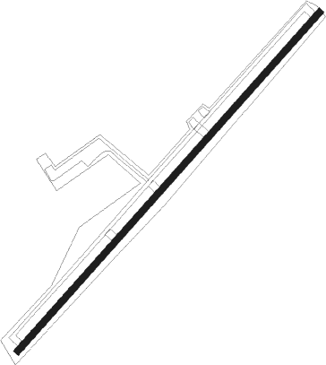
Hillside Lake - Stormville
Airport details
| Country | United States of America |
| State | New York |
| Region | K6 |
| Airspace | Boston Ctr |
| Municipality | Town of East Fishkill |
| Elevation | 356ft (109m) |
| Timezone | GMT -5 |
| Coordinates | 41.57697, -73.73235 |
| Magnetic var | |
| Type | land |
| Available since | X-Plane v10.40 |
| ICAO code | N69 |
| IATA code | n/a |
| FAA code | n/a |
Communication
| STORMVILLE CTAF/UNICOM | 122.800 |
| STORMVILLE NEW YORK Approach/Departure | 132.750 |
Nearby Points of Interest:
Bykenhulle
-Storm-Adriance-Brinckerhoff House
-Murphy Grist Mill
-Beekman Meeting House and Friends' Cemetery
-John Kane House
-LaGrange District Schoolhouse
-Joseph Horton House
-Van Wyck Homestead
-Fishkill Village District
-Elias Titus House
-Akin Free Library
-Wappingers Falls Village Hall
-Wappingers Falls Historic District
-Oblong Friends Meeting House
-Bain Commercial Building
-Dutchess Company Superintendent's House
-Putnam County Courthouse
-Rombout House
-Union Free School
-Reed Memorial Library
-Stone Street Historic District
-Main Street Historic District
-Vassar College Observatory
-Shay's Warehouse and Stable
-Zion Memorial Chapel
Runway info
| Runway 6 / 24 | ||
| length | 1001m (3284ft) | |
| bearing | 54° / 234° | |
| width | 14m (47ft) | |
| surface | asphalt | |
Nearby beacons
| code | identifier | dist | bearing | frequency |
|---|---|---|---|---|
| IGN | KINGSTON VOR/DME | 6.6 | 315° | 117.60 |
| PWL | PAWLING (POUGHKEEPSIE) VOR/DME | 13 | 34° | 114.30 |
| SKU | STANWYCK (NEWBURGH) NDB | 14.3 | 261° | 261 |
| CMK | CARMEL VOR/DME | 19 | 153° | 116.60 |
| SW | NEELY (NEWBURGH) NDB | 22.9 | 260° | 335 |
| BDR | BRIDGEPORT VOR/DME | 37 | 124° | 108.80 |
| HUO | HUGUENOT VOR/DME | 39.9 | 259° | 116.10 |
| PFH | PHILMONT (HUDSON) NDB | 40.6 | 1° | 272 |
| HVN | HAVEN DME | 42.5 | 110° | 109.80 |
| TEB | TETERBORO VOR/DME | 46.2 | 204° | 108.40 |
| SAX | SPARTA VORTAC | 47.5 | 238° | 115.70 |
| LGA | LA GUARDIA (NEW YORK) VOR/DME | 48 | 190° | 113.10 |
| FR | FRIKK (FARMINGDALE) NDB | 49.3 | 163° | 407 |
| TE | TORBY (TETERBORO) NDB | 49.7 | 207° | 214 |
| MM | MOREE (MORRISTOWN) NDB | 49.9 | 221° | 392 |
| DPK | DEER PARK VOR/DME | 50.9 | 151° | 117.70 |
| CTR | CHESTER VOR/DME | 55.3 | 48° | 115.10 |
| JFK | KENNEDY (NEW YORK) VOR/DME | 56.7 | 182° | 115.90 |
| CCC | CALVERTON VOR/DME | 57.3 | 125° | 117.20 |
| CRI | CANARSIE VOR/DME | 58.3 | 190° | 112.30 |
| CAT | CHATHAM NDB | 59.2 | 220° | 254 |
Disclaimer
The information on this website is not for real aviation. Use this data with the X-Plane flight simulator only! Data taken with kind consent from X-Plane 12 source code and data files. Content is subject to change without notice.
