Warwick - Warwick Municipal
Airport details
| Country | United States of America |
| State | New York |
| Region | |
| Airspace | New York Ctr |
| Municipality | Town of Warwick |
| Elevation | 540ft (165m) |
| Timezone | GMT -5 |
| Coordinates | 41.28462, -74.28814 |
| Magnetic var | |
| Type | land |
| Available since | X-Plane v10.40 |
| ICAO code | N72 |
| IATA code | n/a |
| FAA code | N72 |
Communication
Nearby Points of Interest:
Fury Brook Farm
-Warwick Village Historic District
-Jeremiah Morehouse House
-General John Hathorn Stone House
-Culver Randel House and Mill
-Checkerboard Inn
-Village of Monroe Historic District
-Sterling Mountain Fire Observation Tower and Observer's Cabin
-Dutchess Quarry Cave Site
-The Boulders
-District School No. 9
-Sawyer Farmhouse
-High Breeze Farm
-Church Park Historic District
-Arden
-Blooming Grove United Church of Christ
-Rushmore Memorial Library
-Ringwood Manor
-Jacob Sloat House
-Bull Stone House
-Sloat's Dam and Mill Pond
-Sloat House
-Dunning House
-Moffat Library
-Torne Brook Farm
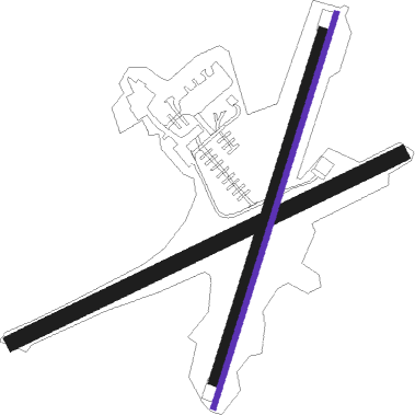
Runway info
| Runway 3R / 21L | ||
| length | 653m (2142ft) | |
| bearing | 28° / 208° | |
| width | 9m (28ft) | |
| surface | asphalt | |
Runway 03L / 21R  | ||
| length | 578m (1896ft) | |
| bearing | 28° / 208° | |
| width | 15m (50ft) | |
| surface | grass | |
| Runway 08 / 26 | ||
| length | 681m (2234ft) | |
| bearing | 74° / 254° | |
| width | 24m (80ft) | |
| surface | grass | |
Nearby beacons
| code | identifier | dist | bearing | frequency |
|---|---|---|---|---|
| SW | NEELY (NEWBURGH) NDB | 12.3 | 17° | 335 |
| HUO | HUGUENOT VOR/DME | 15.6 | 292° | 116.10 |
| SAX | SPARTA VORTAC | 17.2 | 229° | 115.70 |
| SKU | STANWYCK (NEWBURGH) NDB | 18.2 | 45° | 261 |
| MM | MOREE (MORRISTOWN) NDB | 24.3 | 187° | 392 |
| TEB | TETERBORO VOR/DME | 28.1 | 153° | 108.40 |
| TE | TORBY (TETERBORO) NDB | 29.6 | 162° | 214 |
| IGN | KINGSTON VOR/DME | 31 | 51° | 117.60 |
| STW | STILLWATER VOR/DME | 31.4 | 244° | 109.60 |
| CMK | CARMEL VOR/DME | 31.9 | 90° | 116.60 |
| CAT | CHATHAM NDB | 33.2 | 195° | 254 |
| LGA | LA GUARDIA (NEW YORK) VOR/DME | 35.5 | 140° | 113.10 |
| BWZ | BROADWAY (SCHOOLEY'S MT) VOR/DME | 37.9 | 228° | 114.20 |
| PWL | PAWLING (POUGHKEEPSIE) VOR/DME | 42.4 | 55° | 114.30 |
| CRI | CANARSIE VOR/DME | 44.1 | 150° | 112.30 |
| JFK | KENNEDY (NEW YORK) VOR/DME | 45.6 | 142° | 115.90 |
| SBJ | SOLBERG VOR/DME | 46.8 | 213° | 112.90 |
| FR | FRIKK (FARMINGDALE) NDB | 47.5 | 122° | 407 |
| DPK | DEER PARK VOR/DME | 53.5 | 117° | 117.70 |
| COL | COLTS NECK VOR/DME | 58.7 | 172° | 115.40 |
| DNY | DE LANCEY VOR/DME | 61.4 | 323° | 112.10 |
| PFH | PHILMONT (HUDSON) NDB | 63.4 | 30° | 272 |
Disclaimer
The information on this website is not for real aviation. Use this data with the X-Plane flight simulator only! Data taken with kind consent from X-Plane 12 source code and data files. Content is subject to change without notice.