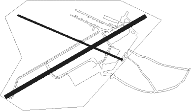
Pittstown - Alexandria
Airport details
| Country | United States of America |
| State | New Jersey |
| Region | |
| Airspace | New York Ctr |
| Municipality | Alexandria Township |
| Elevation | 479ft (146m) |
| Timezone | GMT -5 |
| Coordinates | 40.58572, -75.02347 |
| Magnetic var | |
| Type | land |
| Available since | X-Plane v10.30 |
| ICAO code | N85 |
| IATA code | n/a |
| FAA code | N85 |
Communication
Nearby Points of Interest:
Mount Salem Methodist Episcopal Church
-Mechlin's Corner Tavern
-Old Stone Church
-Thatcher House
-Rockhill Agricultural Historic District
-Perryville Tavern
-Quaker Meeting House
-Uhlerstown–Frenchtown Bridge
-Turner-Chew-Carhart Farm
-Lansdown
-Fink-Type Truss Bridge
-Isaac Stover House
-Music Hall
-M. C. Mulligan & Sons Quarry
-Main Street Bridge
-Dunham's Mill
-Old Grandin Library
-Clinton Historic District
-Locktown Baptist Church
-Hixson–Skinner Mill Complex
-Christoffel Vought Farmstead
-Hixson–Mixsell House
-George Hunt House
-Pursley's Ferry Historic District
-Benjamin Riegel House

Nearby beacons
| code | identifier | dist | bearing | frequency |
|---|---|---|---|---|
| SBJ | SOLBERG VOR/DME | 12.8 | 91° | 112.90 |
| BWZ | BROADWAY (SCHOOLEY'S MT) VOR/DME | 15.7 | 43° | 114.20 |
| ARD | YARDLEY VOR/DME | 20.6 | 161° | 108.20 |
| FJC | ALLENTOWN VORTAC | 21.3 | 288° | 117.50 |
| STW | STILLWATER VOR/DME | 25.6 | 21° | 109.60 |
| CAT | CHATHAM NDB | 28.6 | 75° | 254 |
| ING | AMBLER NDB | 30 | 210° | 275 |
| ETX | EAST TEXAS VOR/DME | 30.1 | 270° | 110.20 |
| PTW | POTTSTOWN VORTAC | 32.8 | 236° | 116.50 |
| RBV | ROBBINSVILLE VORTAC | 33.3 | 126° | 113.80 |
| MM | MOREE (MORRISTOWN) NDB | 35.9 | 67° | 392 |
| SAX | SPARTA VORTAC | 36.3 | 45° | 115.70 |
| GXU | MC GUIRE (WRIGHTSTOWN) VORTAC | 39.7 | 143° | 110.60 |
| TE | TORBY (TETERBORO) NDB | 42.6 | 76° | 214 |
| COL | COLTS NECK VOR/DME | 42.7 | 108° | 115.40 |
| NEL | LAKEHURST TACAN | 45 | 129° | 111.80 |
| NEL | LAKEHURST NDB | 45.2 | 128° | 396 |
| TEB | TETERBORO VOR/DME | 46.5 | 75° | 108.40 |
| MXE | MODENA VORTAC | 49.8 | 224° | 113.20 |
| LVZ | WILKES-BARRE VORTAC | 51.1 | 316° | 111.60 |
| HUO | HUGUENOT VOR/DME | 53.2 | 28° | 116.10 |
| CYN | COYLE VORTAC | 53.5 | 142° | 113.40 |
| OOD | WOODSTOWN VORTAC | 58.4 | 196° | 112.80 |
| DQO | DUPONT (WILMINGTON) VORTAC | 60.7 | 213° | 114 |
| SW | NEELY (NEWBURGH) NDB | 64.9 | 41° | 335 |
| SKU | STANWYCK (NEWBURGH) NDB | 71.8 | 46° | 261 |
Instrument approach procedures
| runway | airway (heading) | route (dist, bearing) |
|---|---|---|
| RWNVA | ARD (341°) | ARD JABAH (17mi, 305°) 2700ft YODAH (5mi, 353°) 2700ft |
| RWNVA | BWZ (223°) | BWZ YODAH (24mi, 233°) 2700ft YODAH (turn) 2700ft |
| RWNVA | FJC (108°) | FJC OBIWN (12mi, 128°) 2700ft YODAH (5mi, 126°) 2700ft |
| RWNVA | SBJ (271°) | SBJ YODAH (21mi, 263°) 2700ft YODAH (turn) 2700ft |
| RNAV | YODAH 2700ft RTWOO (4mi, 70°) 2100ft N85 (4mi, 70°) 498ft (4725mi, 118°) 880ft LIZZI (4732mi, 298°) 3000ft LIZZI (turn) | |
| RWNVB | ARD (341°) | ARD HANSS (24mi, 9°) 3000ft HANSS (turn) 3000ft |
| RWNVB | BWZ (223°) | BWZ CHEWE (4mi, 194°) 3000ft HANSS (5mi, 187°) 3000ft |
| RWNVB | FJC (108°) | FJC HANSS (28mi, 97°) 3000ft HANSS (turn) 3000ft |
| RWNVB | SBJ (271°) | SBJ HANSS (6mi, 302°) 3000ft |
| RNAV | HANSS 3000ft SOLOA (5mi, 250°) 2100ft N85 (4mi, 250°) 510ft (4725mi, 118°) 880ft LIZZI (4732mi, 298°) 3000ft LIZZI (turn) |
Disclaimer
The information on this website is not for real aviation. Use this data with the X-Plane flight simulator only! Data taken with kind consent from X-Plane 12 source code and data files. Content is subject to change without notice.