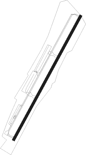
Napanoch - Joseph Y Resnick
Airport details
| Country | United States of America |
| State | New York |
| Region | K6 |
| Airspace | Boston Ctr |
| Municipality | Town of Wawarsing |
| Elevation | 291ft (89m) |
| Timezone | GMT -5 |
| Coordinates | 41.72787, -74.37737 |
| Magnetic var | |
| Type | land |
| Available since | X-Plane v10.40 |
| ICAO code | N89 |
| IATA code | n/a |
| FAA code | n/a |
Communication
| Joseph Y Resnick CTAF/UNICOM | 122.800 |
| Joseph Y Resnick NEW YORK Approach/Departure | 132.750 |
Nearby Points of Interest:
Ontario and Western Railroad Passenger Station
-United States Post Office
-O & W Railroad Station at Port Ben
-Cragsmoor Historic District
-Sam's Point Preserve
-Chetolah
-Terwilliger-Smith Farm
-Schoonmaker Stone House and Farm
-Jacob Hoornbeck Stone House
-Benjamin Van Keuren House Ruin
-Thomas Jansen House
-Johannes Jansen House
-Pearl Street Schoolhouse
-J. Dupuy Stone House
-C. K. Schoonmaker Stone House
-William Decker House
-Ulster Heights Synagogue
-Dill Farm
-Hebrew Congregation of Mountaindale Synagogue
-Trapps Mountain Hamlet Historic District
-Miller's House at Red Mills
-Taylor-Corwin House
-Delaware and Hudson Canal
-Bruynswick School No. 8
-Brykill Farms
Nearby beacons
| code | identifier | dist | bearing | frequency |
|---|---|---|---|---|
| SW | NEELY (NEWBURGH) NDB | 16 | 148° | 335 |
| SKU | STANWYCK (NEWBURGH) NDB | 19.1 | 121° | 261 |
| HUO | HUGUENOT VOR/DME | 21.3 | 214° | 116.10 |
| IGN | KINGSTON VOR/DME | 25.1 | 96° | 117.60 |
| PWL | PAWLING (POUGHKEEPSIE) VOR/DME | 34.8 | 87° | 114.30 |
| DNY | DE LANCEY VOR/DME | 37.4 | 308° | 112.10 |
| SAX | SPARTA VORTAC | 40.3 | 194° | 115.70 |
| PFH | PHILMONT (HUDSON) NDB | 42.9 | 51° | 272 |
| CMK | CARMEL VOR/DME | 44.7 | 119° | 116.60 |
| HNK | HANCOCK VOR/DME | 46.5 | 290° | 116.80 |
| STW | STILLWATER VOR/DME | 49.2 | 214° | 109.60 |
| MM | MOREE (MORRISTOWN) NDB | 50.9 | 177° | 392 |
| TEB | TETERBORO VOR/DME | 54.6 | 160° | 108.40 |
| TE | TORBY (TETERBORO) NDB | 56.5 | 165° | 214 |
| RKA | ROCKDALE VOR/DME | 58.6 | 311° | 112.60 |
| BWZ | BROADWAY (SCHOOLEY'S MT) VOR/DME | 59.3 | 206° | 114.20 |
| CAT | CHATHAM NDB | 59.3 | 183° | 254 |
| LGA | LA GUARDIA (NEW YORK) VOR/DME | 61.1 | 152° | 113.10 |
| FR | FRIKK (FARMINGDALE) NDB | 69.9 | 137° | 407 |
Instrument approach procedures
| runway | airway (heading) | route (dist, bearing) |
|---|---|---|
| RW04 | CRANK (2°) | CRANK BURLL (13mi, 317°) 3500ft |
| RW04 | RAGER (73°) | RAGER BURLL (16mi, 85°) 3500ft |
| RNAV | BURLL 3500ft LOBOS (5mi, 55°) 2600ft FEBRA (5mi, 57°) 611ft (4709mi, 119°) 692ft MAILS (4707mi, 299°) 6000ft MAILS (turn) 6000ft | |
| RW22 | IGN (276°) | IGN STELR (22mi, 298°) 3300ft |
| RW22 | TALCO (219°) | TALCO ECZID (4mi, 211°) 4300ft STELR (8mi, 211°) 3300ft |
| RNAV | STELR 3300ft MAILS (6mi, 232°) 2200ft YARNN (5mi, 221°) 509ft (4709mi, 119°) 692ft LOBOS (4713mi, 299°) 4000ft LOBOS (turn) 4000ft |
Disclaimer
The information on this website is not for real aviation. Use this data with the X-Plane flight simulator only! Data taken with kind consent from X-Plane 12 source code and data files. Content is subject to change without notice.
