Hertford - May
Airport details
| Country | United States of America |
| State | North Carolina |
| Region | K7 |
| Airspace | Washington Ctr |
| Municipality | Perquimans County |
| Elevation | 775ft (236m) |
| Timezone | GMT -5 |
| Coordinates | 36.09622, -76.32706 |
| Magnetic var | |
| Type | land |
| Available since | X-Plane v10.40 |
| ICAO code | NC01 |
| IATA code | n/a |
| FAA code | NC01 |
Communication
Nearby Points of Interest:
Land's End
-Sutton-Newby House
-Isaac White House
-Newbold-White House
-Cove Grove
-Myers-White House
-Stockton
-Perquimans County Courthouse
-Sandy Point
-Columbia Historic District
-Scuppernong River Bridge
-Tyrrell County Courthouse
-Mulberry Hill
-Athol
-Episcopal Cemetery
-Norfolk Southern Passenger Station
-Elizabeth City Historic District
-Riverside Historic District
-Strawberry Hill
-Edenton Cotton Mill Historic District
-Northside Historic District
-Hayes Plantation
-James Iredell House
-Elizabeth City Water Plant
-Chowan County Courthouse
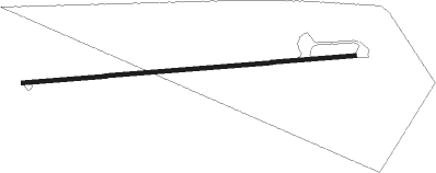
Runway info
| Runway 9 / 27 | ||
| length | 706m (2316ft) | |
| bearing | 90° / 270° | |
| width | 8m (25ft) | |
| surface | asphalt | |
Nearby beacons
| code | identifier | dist | bearing | frequency |
|---|---|---|---|---|
| LLW | WOODVILLE (ELIZABETH CITY) NDB | 10.1 | 10° | 254 |
| ECG | ELIZABETH CITY VOR/DME | 12.1 | 43° | 112.50 |
| CVI | COFIELD VORTAC | 31.1 | 297° | 114.60 |
| RBX | WRIGHT BROTHERS (MANTEO) VOR/DME | 32.3 | 106° | 111.60 |
| MQI | MANTEO NDB | 32.5 | 106° | 370 |
| NFE | CHESAPEAKE TACAN | 37.2 | 18° | 108.25 |
| OR | INGLE (NORFOLK) NDB | 44.8 | 6° | 329 |
| NTU | OCEANA TACAN | 45.9 | 22° | 116.60 |
| ORF | NORFOLK VORTAC | 48.1 | 9° | 116.90 |
| FKN | FRANKLIN VORTAC | 49.7 | 312° | 110.60 |
| NGU | CHAMBERS (NORFOLK) TACAN | 50.7 | 3° | 113.95 |
| RNW | CHOCOWINITY NDB | 51.7 | 233° | 388 |
| LFI | LANGLEY (HAMPTON) TACAN | 59.4 | 358° | 112.30 |
| AKQ | WAKEFIELD NDB | 62.3 | 323° | 274 |
Instrument approach procedures
| runway | airway (heading) | route (dist, bearing) |
|---|---|---|
| RW03 | BERTI (83°) | BERTI ZADPA (8mi, 118°) 2000ft GIGTE (7mi, 105°) 2000ft |
| RNAV | GIGTE 2000ft UDUNE (6mi, 22°) 1100ft NC01 (4mi, 22°) 48ft (4744mi, 115°) 210ft EGGAB (4743mi, 295°) SUNNS (20mi, 324°) 2000ft SUNNS (turn) | |
| RW21 | SUNNS (152°) | SUNNS VAPSY (16mi, 121°) 2000ft |
| RNAV | VAPSY 2000ft EGGAB (8mi, 203°) 1100ft NC01 (4mi, 202°) 48ft (4744mi, 115°) 420ft BERTI (4760mi, 295°) 4000ft BERTI (turn) |
Disclaimer
The information on this website is not for real aviation. Use this data with the X-Plane flight simulator only! Data taken with kind consent from X-Plane 12 source code and data files. Content is subject to change without notice.