Chapel Hill - Miles
Airport details
| Country | United States of America |
| State | North Carolina |
| Region | |
| Airspace | Washington Ctr |
| Municipality | Orange County |
| Elevation | 580ft (177m) |
| Timezone | GMT -5 |
| Coordinates | 35.97863, -79.13100 |
| Magnetic var | |
| Type | land |
| Available since | X-Plane v10.40 |
| ICAO code | NC34 |
| IATA code | n/a |
| FAA code | NC34 |
Communication
Nearby Points of Interest:
Thomas and Mary Hogan House
-Moorefields
-Carrboro Commercial Historic District
-Thomas F. Lloyd Historic District
-Chapel Hill Town Hall
-Beta Theta Pi Fraternity House
-Chapel Hill Historic District
-Nash-Hooper House
-Old East
-Playmakers Theatre
-North Carolina Polytechnic Academy
-Chapel of the Cross
-Bellevue Manufacturing Company
-Rigsbee's Rock House
-Occoneechee Speedway
-Nash Law Office
-Hillsborough Historic District
-Eagle Lodge
-St. Matthew's Episcopal Church and Churchyard
-Heartsease
-Hazel-Nash House
-Ayr Mount
-Bingham School
-Burwell School
-Ruffin-Roulhac House
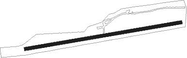
Runway info
| Runway 09 / 27 | ||
| length | 701m (2300ft) | |
| bearing | 86° / 266° | |
| width | 15m (50ft) | |
| surface | grass | |
Nearby beacons
| code | identifier | dist | bearing | frequency |
|---|---|---|---|---|
| HUR | PERSON (ROXBORO) NDB | 15.6 | 14° | 220 |
| RDU | RALEIGH-DURHAM VORTAC | 18 | 107° | 117.20 |
| LE | LEEVY (RALEIGH/DURHAM) NDB | 20.1 | 97° | 350 |
| HB | ALAMM NDB | 22 | 270° | 361 |
| LIB | LIBERTY VORTAC | 25.4 | 251° | 113 |
| HXO | HUNTSBORO (OXFORD) NDB | 31.5 | 58° | 271 |
| DAN | DANVILLE VOR | 36.8 | 341° | 113.10 |
| SIF | SLAMMER (REIDSVILLE) NDB | 39 | 303° | 423 |
| HQT | HARNETT (ERWIN) NDB | 39.6 | 140° | 417 |
| GSO | GREENSBORO VORTAC | 41.2 | 275° | 116.20 |
| SBV | SOUTH BOSTON VORTAC | 42.2 | 9° | 110.40 |
| JN | JURLY (SMITHFIELD) NDB | 45.8 | 126° | 263 |
| POB | POPE (FAYETTEVILLE) NDB | 45.9 | 167° | 338 |
| POB | POPE (FAYETTEVILLE) TACAN | 48.9 | 172° | 113.80 |
| SDZ | SANDHILLS (SOUTHERN PINES VORTAC | 50.9 | 211° | 111.80 |
| FGP | FORT BRAGG NDB | 52.7 | 159° | 393 |
| UV | BALES (MARTINSVILLE) NDB | 52.8 | 308° | 396 |
| VU | ALLER (ALBEMARLE) NDB | 54.9 | 243° | 346 |
| FAY | FAYETTEVILLE VOR/DME | 60.9 | 166° | 108.80 |
Disclaimer
The information on this website is not for real aviation. Use this data with the X-Plane flight simulator only! Data taken with kind consent from X-Plane 12 source code and data files. Content is subject to change without notice.