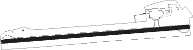
Avarua - Rarotonga Intl
Airport details
| Country | Cook Islands |
| State | Rarotonga |
| Region | NC |
| Municipality | Avarua |
| Elevation | 19ft (6m) |
| Timezone | GMT -10 |
| Coordinates | -21.20087, -159.79495 |
| Magnetic var | |
| Type | land |
| Available since | X-Plane v10.40 |
| ICAO code | NCRG |
| IATA code | RAR |
| FAA code | n/a |
Communication
| Rarotonga Intl Tower | 121.900 |
| Rarotonga Intl Tower | 118.100 |
| Rarotonga Intl Approach | 121.900 |
| Rarotonga Intl Approach | 118.100 |
Approach frequencies
| ILS-cat-I | RW26 | 110.3 | 18.00mi |
| ILS-cat-I | RW08 | 109.9 | 18.00mi |
| 3° GS | RW26 | 110.3 | 18.00mi |
| 3° GS | RW08 | 109.9 | 18.00mi |
Nearby beacons
| code | identifier | dist | bearing | frequency |
|---|---|---|---|---|
| RG | RAROTONGA VOR/DME | 1 | 268° | 113.50 |
| RG | RAROTONGA NDB | 1.5 | 256° | 352 |
Departure and arrival routes
| Transition altitude | 13000ft |
| Transition level | 13000ft |
| SID end points | distance | outbound heading | |
|---|---|---|---|
| RW08 | |||
| BAVE1T | 30mi | 112° | |
| BELI1R | 70mi | 250° | |
| TOKE1P | 70mi | 359° | |
| RW26 | |||
| ATSO1Q | 70mi | 359° | |
| STAR starting points | distance | inbound heading | |
|---|---|---|---|
| RW08 | |||
| ANIV1A | 15.0 | 90° | |
| OSPI1A | 16.0 | 109° | |
| BAVE1A | 29.7 | 292° | |
| RW26 | |||
| KARS1B | 15.0 | 250° | |
| NOLA1B | 13.9 | 270° | |
| SAKA1B | 14.8 | 289° | |
Instrument approach procedures
| runway | airway (heading) | route (dist, bearing) |
|---|---|---|
| RW08-W | OPUNA (90°) | OPUNA 3000ft |
| RW08-W | RAKIA (67°) | RAKIA OPUNA (5mi, 0°) 2000ft |
| RW08-W | TOKEA (113°) | TOKEA OPUNA (5mi, 180°) 2000ft |
| RNAV | OPUNA 2000ft 16NM (4mi, 90°) 2000ft ADLIS (2mi, 90°) 1500ft NCRG (6mi, 89°) 69ft RG597 (turn) RG732 (2mi, 76°) RG656 (3mi, 81°) ANGAI (5mi, 100°) 3100ft | |
| RW08-X | OPUNA (90°) | OPUNA 3000ft |
| RW08-X | RAKIA (67°) | RAKIA OPUNA (5mi, 0°) 3000ft |
| RW08-X | TOKEA (113°) | TOKEA OPUNA (5mi, 180°) 3000ft |
| RNAV | OPUNA 3000ft RG401 (4mi, 90°) 1820ft RG405 (3mi, 90°) 802ft OPUNA (8mi, 270°) 3000ft | |
| RW08-Y | OPUNA (90°) | OPUNA 3000ft |
| RW08-Y | RAKIA (67°) | RAKIA OPUNA (5mi, 0°) 3000ft |
| RW08-Y | TOKEA (113°) | TOKEA OPUNA (5mi, 180°) 3000ft |
| RNAV | OPUNA 3000ft RG401 (4mi, 90°) 1820ft RG403 (3mi, 90°) 866ft OPUNA (7mi, 270°) 3000ft | |
| RW08-Z | OPUNA (90°) | OPUNA 3000ft |
| RW08-Z | RAKIA (67°) | RAKIA OPUNA (5mi, 0°) 3000ft |
| RW08-Z | TOKEA (113°) | TOKEA OPUNA (5mi, 180°) 3000ft |
| RNAV | OPUNA 3000ft RG401 (4mi, 90°) 1820ft NCRG (7mi, 89°) 69ft ANGAI (10mi, 91°) 3100ft | |
| RW26-Y | ANGAI (271°) | ANGAI 3100ft |
| RW26-Y | MOAKE (245°) | MOAKE ANGAI (5mi, 180°) 2000ft |
| RW26-Y | MURIA (296°) | MURIA ANGAI (5mi, 0°) 2000ft |
| RNAV | ANGAI 2000ft 16NM2 (4mi, 270°) 2000ft PEXIS (2mi, 270°) 1500ft NCRG (4mi, 271°) 65ft RG483 (2mi, 267°) OPUNA (9mi, 270°) 3000ft | |
| RW26-Z | ANGAI (271°) | ANGAI 3100ft |
| RW26-Z | MOAKE (245°) | MOAKE ANGAI (5mi, 180°) 3000ft |
| RW26-Z | MURIA (296°) | MURIA ANGAI (5mi, 0°) 3000ft |
| RNAV | ANGAI 3000ft RG407 (4mi, 270°) 1980ft NCRG (6mi, 271°) 65ft OPUNA (11mi, 270°) 3000ft |
Disclaimer
The information on this website is not for real aviation. Use this data with the X-Plane flight simulator only! Data taken with kind consent from X-Plane 12 source code and data files. Content is subject to change without notice.