Ramah - Mystic Bluffs
Airport details
| Country | United States of America |
| State | New Mexico |
| Region | |
| Airspace | Albuquerque Ctr |
| Municipality | Cibola County |
| Elevation | 6979ft (2127m) |
| Timezone | GMT -7 |
| Coordinates | 35.16531, -108.45896 |
| Magnetic var | |
| Type | land |
| Available since | X-Plane v10.40 |
| ICAO code | NM56 |
| IATA code | n/a |
| FAA code | NM56 |
Communication
| Mystic Bluffs UNICOM | 123.000 |
Nearby Points of Interest:
Bowlin's Old Crater Trading Post
-McKinley County Courthouse
-Lebanon Lodge No. 22
-Drake Hotel
-United States Post Office
-Gallup Commercial Historic District
-El Morro Theater
-Charley's Automotive Service
-Hawikuh Ruins
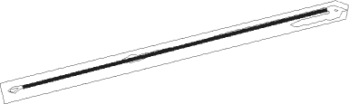
Runway info
| Runway 06 / 24 | ||
| length | 1410m (4626ft) | |
| bearing | 82° / 262° | |
| width | 12m (40ft) | |
| surface | dirt | |
Nearby beacons
| code | identifier | dist | bearing | frequency |
|---|---|---|---|---|
| GUP | GALLUP VORTAC | 27.5 | 307° | 115.10 |
| ZUN | ZUNI VORTAC | 36.2 | 254° | 113.40 |
| SJN | ST JOHNS VORTAC | 55.8 | 223° | 112.30 |
Disclaimer
The information on this website is not for real aviation. Use this data with the X-Plane flight simulator only! Data taken with kind consent from X-Plane 12 source code and data files. Content is subject to change without notice.