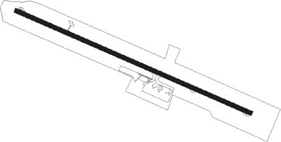
Port Vila - Bauerfield
Airport details
| Country | Vanuatu |
| State | Shefa Province |
| Region | NV |
| Municipality | Port Vila |
| Elevation | 66ft (20m) |
| Timezone | GMT +11 |
| Coordinates | -17.69933, 168.31979 |
| Magnetic var | |
| Type | land |
| Available since | X-Plane v10.40 |
| ICAO code | NVVV |
| IATA code | VLI |
| FAA code | n/a |
Communication
| Bauerfield Vila FIS | 120.700 |
| Bauerfield Vila Tower | 118.300 |
Approach frequencies
| LOC | RW11 | 110.7 | 18.00mi |
Nearby beacons
| code | identifier | dist | bearing | frequency |
|---|---|---|---|---|
| BA | PORT VILA NDB | 2.9 | 278° | 361 |
| VLI | PORT VILA VOR/DME | 4.8 | 296° | 114.30 |
Departure and arrival routes
| Transition altitude | 11000ft |
| Transition level | 13000ft |
| SID end points | distance | outbound heading | |
|---|---|---|---|
| RW11 | |||
| EMTEN1 | 18mi | 248° | |
| RW29 | |||
| 29E | 125mi | 90° | |
| MELE1 | 18mi | 248° | |
| 29N | 146mi | 333° | |
Instrument approach procedures
| runway | airway (heading) | route (dist, bearing) |
|---|---|---|
| RW11-U | BONJU (56°) | BONJU 3600ft NV564 (3mi, 25°) 2570ft NV504 (4mi, 41°) 1140ft |
| RW11-U | ENZED (10°) | ENZED 5300ft NV544 (8mi, 337°) 2760ft NV504 (5mi, 12°) 1140ft |
| RW11-U | JOZEF (145°) | JOZEF 4400ft NV588 (4mi, 172°) 4400ft KASTN (7mi, 188°) 4400ft NV506 (7mi, 121°) 1510ft NV504 (1mi, 56°) 1140ft |
| RW11-U | KUSIN (265°) | KUSIN 4900ft DORTA (5mi, 258°) 4900ft LAGUN (13mi, 245°) 4900ft NV544 (6mi, 285°) 2760ft NV504 (5mi, 12°) 1140ft |
| RW11-U | OCKER (68°) | OCKER 5900ft NV524 (10mi, 61°) 2760ft NV506 (4mi, 59°) 1510ft NV504 (1mi, 56°) 1140ft |
| RNAV | NV504 1140ft NV500 (2mi, 87°) 430ft NVVV (2mi, 117°) 101ft NV502 (turn) NV532 (turn) NV538 (4mi, 194°) NV550 (2mi, 251°) 3400ft | |
| RW11 | AF11N (110°) | AF11N IF11 (5mi, 157°) 2000ft |
| RW11 | AF11S (72°) | AF11S IF11 (5mi, 18°) 2000ft |
| RW11 | AF11W (91°) | AF11W IF11 (5mi, 87°) 2000ft |
| RNAV | IF11 2000ft FF11 (5mi, 89°) 2000ft MA11 (5mi, 88°) 348ft MAH11 (10mi, 193°) 2000ft | |
| RW29-U | BRATA (62°) | BRATA 4900ft MARMA (29mi, 80°) 4900ft NV508 (8mi, 9°) 1290ft |
| RW29-U | ERTAP (5°) | ERTAP 4900ft MARMA (6mi, 35°) 4900ft NV508 (8mi, 9°) 1290ft |
| RW29-U | JOZEF (145°) | JOZEF 4900ft NV516 (23mi, 161°) 4900ft MARMA (6mi, 119°) 4900ft NV508 (8mi, 9°) 1290ft |
| RW29-U | KUSIN (265°) | KUSIN 5200ft DORTA (5mi, 258°) 5200ft NV528 (5mi, 245°) 3220ft NV508 (5mi, 271°) 1290ft |
| RW29-U | MISSU (35°) | MISSU 4900ft NV530 (8mi, 34°) 4900ft NV520 (8mi, 52°) 4900ft MARMA (8mi, 70°) 4900ft NV508 (8mi, 9°) 1290ft |
| RNAV | NV508 1290ft NVVV (4mi, 297°) 130ft NV500 (2mi, 297°) NV504 (2mi, 267°) NV544 (5mi, 192°) 3400ft | |
| RW29 | AF29E (297°) | AF29E IF29 (5mi, 297°) 2000ft |
| RW29 | AF29N (278°) | AF29N IF29 (5mi, 229°) 2000ft |
| RW29 | AF29S (316°) | AF29S IF29 (5mi, 8°) 2000ft |
| RNAV | IF29 2000ft FF29 (5mi, 297°) 2000ft MA29 (5mi, 297°) 439ft MAH29 (10mi, 193°) 2000ft |
Disclaimer
The information on this website is not for real aviation. Use this data with the X-Plane flight simulator only! Data taken with kind consent from X-Plane 12 source code and data files. Content is subject to change without notice.
