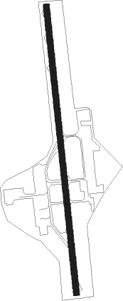
Nouméa - Noumea Magenta
Airport details
| Country | France |
| State | [Other] |
| Region | NW |
| Municipality | Noumea |
| Elevation | 8ft (2m) |
| Timezone | GMT +11 |
| Coordinates | -22.25833, 166.47278 |
| Magnetic var | |
| Type | land |
| Available since | X-Plane v10.40 |
| ICAO code | NWWM |
| IATA code | GEA |
| FAA code | n/a |
Communication
| Noumea Magenta ATIS | 126.600 |
| Noumea Magenta Tower | 118.300 |
| Noumea Magenta Approach | 124.300 |
Runway info
| Runway 17 / 35 | ||
| length | 1391m (4564ft) | |
| bearing | 178° / 358° | |
| width | 30m (98ft) | |
| surface | concrete | |
| displ threshold | 275m (902ft) / 95m (312ft) | |
Nearby beacons
| code | identifier | dist | bearing | frequency |
|---|---|---|---|---|
| MG | MAGENTA (NOUMEA) NDB | 0.6 | 178° | 394 |
| MGA | OUERE (NOUMEA) VOR/DME | 3.4 | 180° | 113 |
| MD | MAGENTA (NOUMEA) NDB | 13.1 | 181° | 383 |
| LTO | TONTOUTA (NOUMEA) VOR/DME | 21 | 314° | 112.90 |
| FND | TONTOUTA (NOUMEA) NDB | 22.1 | 312° | 354 |
| NW | TONTOUTA (NOUMEA) NDB | 29.3 | 309° | 325 |
| IP | ILE DES PINS NDB | 57.8 | 109° | 332 |
Departure and arrival routes
| Transition altitude | 11000ft |
| Transition level | 13000ft |
| SID end points | distance | outbound heading | |
|---|---|---|---|
| RW17 | |||
| IP1A, IP1C | 58mi | 109° | |
| LTO3A | 21mi | 314° | |
| RW35 | |||
| IP2B, IP2F | 58mi | 109° | |
| LTO4B | 21mi | 314° | |
| STAR starting points | distance | inbound heading | |
|---|---|---|---|
| ALL | |||
| KQ1M, KQ1N, KQ1S, KQ1T | 113.0 | 126° | |
| LTO1N | 21.0 | 134° | |
| TH1N, TH1T | 111.3 | 140° | |
| IP1N, IP1R | 57.8 | 289° | |
Holding patterns
| STAR name | hold at | type | turn | heading* | altitude | leg | speed limit |
|---|---|---|---|---|---|---|---|
| IP1R | REDIK | VHF | left | 125 (305)° | 1800ft - 6000ft | DME 4.0mi | 170 |
| *) magnetic outbound (inbound) holding course | |||||||
Disclaimer
The information on this website is not for real aviation. Use this data with the X-Plane flight simulator only! Data taken with kind consent from X-Plane 12 source code and data files. Content is subject to change without notice.
