Johnstown - Fulton County
Airport details
| Country | United States of America |
| State | New York |
| Region | K6 |
| Airspace | Boston Ctr |
| Municipality | Town of Johnstown |
| Elevation | 878ft (268m) |
| Timezone | GMT -5 |
| Coordinates | 42.99820, -74.32956 |
| Magnetic var | |
| Type | land |
| Available since | X-Plane v10.40 |
| ICAO code | NY0 |
| IATA code | n/a |
| FAA code | NY0 |
Communication
| Fulton County AWOS | 119.225 |
| Fulton County CTAF/UNICOM | 122.700 |
| Fulton County ALBANY Approach/Departure | 118.050 |
Nearby Points of Interest:
Benjamin Chamberlain House
-United States Post Office
-Fulton County Courthouse
-Gloversville Free Library
-Caughnawaga Indian Village Site
-Glen Historic District
-Amsterdam Castle
-Greene Mansion
-Saint Stanislaus Roman Catholic Church Complex
-First Baptist Church
-Trinity Lutheran Church and Cemetery (Stone Arabia, New York)
-Reformed Dutch Church of Stone Arabia
-Webster Wagner House
-Canajoharie Historic District
-West Hill School
-Bragdon-Lipe House
-Frey House
-Walrath-Van Horne House
-West Charlton United Presbyterian Church
-Fort Plain Historic District
-Kane Mountain Fire Observation Station
-Shute Octagon House
-A.D. (Boss) Jones House
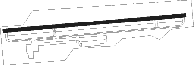
Runway info
| Runway 10 / 28 | ||
| length | 1216m (3990ft) | |
| bearing | 90° / 270° | |
| width | 23m (75ft) | |
| surface | asphalt | |
Nearby beacons
| code | identifier | dist | bearing | frequency |
|---|---|---|---|---|
| JJH | JOHNSTOWN NDB | 0.1 | 303° | 523 |
| HEU | HUNTER (SCHENECTADY) NDB | 19.4 | 110° | 356 |
| AL | HAWKY (ALBANY) NDB | 25.3 | 109° | 219 |
| ALB | ALBANY VORTAC | 27.6 | 115° | 115.30 |
| GF | GANSE (GLENS FALLS) NDB | 35.2 | 70° | 209 |
| UCA | UTICA TACAN | 36.7 | 272° | 111.20 |
| CAM | CAMBRIDGE VOR/DME | 43.2 | 90° | 115 |
| RKA | ROCKDALE VOR/DME | 51.2 | 240° | 112.60 |
| PFH | PHILMONT (HUDSON) NDB | 52.1 | 141° | 272 |
| DNY | DE LANCEY VOR/DME | 56.5 | 217° | 112.10 |
| HNK | HANCOCK VOR/DME | 71.1 | 227° | 116.80 |
Instrument approach procedures
| runway | airway (heading) | route (dist, bearing) |
|---|---|---|
| RW10 | ASQEV (90°) | ASQEV 3700ft |
| RW10 | ELHUC (73°) | ELHUC 3700ft ASQEV (5mi, 359°) 3700ft |
| RW10 | IQNIS (106°) | IQNIS 3900ft ASQEV (5mi, 179°) 3700ft |
| RNAV | ASQEV 3700ft EYIZU (7mi, 90°) 3000ft QIQZI (3mi, 90°) 1920ft NY0 (3mi, 90°) 918ft LURYO (11mi, 90°) 3700ft LURYO (turn) | |
| RW28 | COMUM (251°) | COMUM 3900ft LURYO (5mi, 180°) 3700ft |
| RW28 | JUPEV (288°) | JUPEV 3700ft LURYO (5mi, 360°) 3700ft |
| RW28 | LURYO (270°) | LURYO 3700ft |
| RNAV | LURYO 3700ft IQHET (5mi, 270°) 3000ft YIYIW (3mi, 270°) 1940ft NY0 (3mi, 270°) 940ft ASQEV (12mi, 270°) 4000ft ASQEV (turn) |
Disclaimer
The information on this website is not for real aviation. Use this data with the X-Plane flight simulator only! Data taken with kind consent from X-Plane 12 source code and data files. Content is subject to change without notice.