Airports for X-Plane offers a convenient way to explore airports and their related communication information for the X-Plane flight simulator. It only uses data from the X-Plane flight simulator itself, and is therefore more reliable than the data that comes from real aviation websites. You can search for airports by using the ICAO code, or browse for airports per country and state. The information displayed is categorized by airport details, runway information, airport communication, approach frequencies (ILS and Glidepath details), details of nearby beacons, SIDs, STARs and approach procedures.

seaplanes flight attendant runway nearby hangar aircraft train downtown newark taxi plane passengers control tower international terminal nation arriving airliner road station

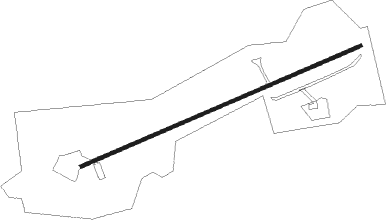
Plattsburgh - Adirondack Airpark Estates

Airport details

CountryUnited States of America
StateNew York
Region
AirspaceBoston Ctr
MunicipalityTown of Saranac
Elevation1352ft (412m)
TimezoneGMT -5
Coordinates44.60111, -73.85626
Magnetic var
Typeland
Available sinceX-Plane v10.30
ICAO codeNY17
IATA coden/a
FAA codeNY17

Communication

No airport communication available for NY17
Nearby Points of Interest:
Lyon Mountain Railroad Station
-
Merrillsville Cure Cottage
-
Palmer Brook Bridge
-
Loon Lake Mountain Fire Observation Station
-
Miller Homestead
-
Peru Community Church
-
Heyworth–Mason Industrial Building
-
Wells Memorial Library
-
Keeseville Historic District
-
Stone Arch Bridge
-
Tomlinson House
-
Rembrandt Hall
-
Winslow-Turner Carriage House
-
Hopkins Cottage
-
AuSable Chasm Bridge
-
Hawkins Hall
-
Old State Road Bridge
-
Carpenter's Flats Bridge
-
S. F. Vilas Home for Aged & Infirmed Ladies
-
William Bailey House
-
W. W. Hartwell House & Dependencies
-
Court Street Historic District
-
Brinkerhoff Street Historic District
-
Charles C. Platt Homestead
-
Valcour Bay

Runway info

Runway 9 / 27
 length565m (1854ft)
 bearing76° / 256°
 width6m (20ft)
 surfaceasphalt

Airport layout


Nearby beacons

codeidentifierdistbearingfrequency
SLKLAKE DME19.7238°109.20
BTHERRO (BURLINGTON) NDB26.296°382
BJABURLINGTON TACAN30.8100°112.40
BTVBURLINGTON VOR/DME31.3107°117.50
MSSMASSENA TACAN41.4290°114.10
YJNDME45.439°115.80
ZHUHAUTS-BOIS (MONTREAL) NDB61.728°407
DYOSMUTO (RUTLAND) NDB66.2135°221

Disclaimer

The information on this website is not for real aviation. Use this data with the X-Plane flight simulator only! Data taken with kind consent from X-Plane 12 source code and data files. Content is subject to change without notice.