Balclutha
Airport details
| Country | New Zealand |
| State | Otago |
| Region | NZ |
| Municipality | Clutha District |
| Elevation | 20ft (6m) |
| Timezone | GMT +13 |
| Coordinates | -46.24333, 169.75000 |
| Magnetic var | |
| Type | land |
| Available since | X-Plane v10.32 |
| ICAO code | NZBA |
| IATA code | n/a |
| FAA code | n/a |
Communication
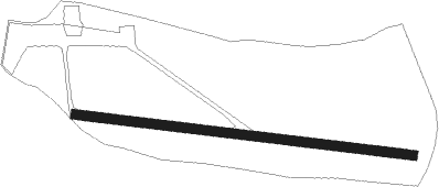
Runway info
| Runway 07 / 25 | ||
| length | 705m (2313ft) | |
| bearing | 98° / 278° | |
| width | 20m (66ft) | |
| surface | grass | |
Nearby beacons
| code | identifier | dist | bearing | frequency |
|---|---|---|---|---|
| BE | BERRIDALE (DUNEDIN) NDB | 16.1 | 47° | 394 |
| HL | HENLEY (DUNEDIN) NDB | 24.7 | 54° | 378 |
| MI | MOSGIEL NDB | 32.6 | 57° | 358 |
| SW | SWAMPY (DUNEDIN) VOR/DME | 40.5 | 58° | 112.70 |
Disclaimer
The information on this website is not for real aviation. Use this data with the X-Plane flight simulator only! Data taken with kind consent from X-Plane 12 source code and data files. Content is subject to change without notice.