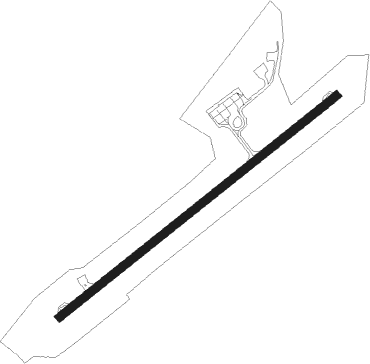
Dunedin
Airport details
| Country | New Zealand |
| State | Otago |
| Region | NZ |
| Municipality | Dunedin City |
| Elevation | 2ft (1m) |
| Timezone | GMT +12 |
| Coordinates | -45.92805, 170.19833 |
| Magnetic var | |
| Type | land |
| Available since | X-Plane v10.40 |
| ICAO code | NZDN |
| IATA code | DUD |
| FAA code | n/a |
Communication
| Dunedin ATIS | 126.450 |
| Dunedin CTAF | 120.700 |
| Dunedin Tower | 120.700 |
| Dunedin CHRISTCHURCH CON | 129.300 |
| Dunedin Tower | 122.400 |
| Dunedin Approach | 120.700 |
| Dunedin Approach | 122.400 |
Approach frequencies
| ILS-cat-I | RW21 | 109.9 | 18.00mi |
| ILS-cat-I | RW03 | 110.3 | 18.00mi |
| 3° GS | RW21 | 109.9 | 18.00mi |
| 3° GS | RW03 | 110.3 | 18.00mi |
Nearby Points of Interest:
Mosgiel Woollen Mill
-Carisbrook
-Mayfair Theatre
-St Michael's Antiochian Orthodox Church
-King Edward Technical College
-Former Holy Trinity Methodist Church, Dunedin
-Dunedin Athenaeum and Mechanics' Institute
-Consultancy House
-Dunedin Cenotaph
-Allied Press
-Hanover Street Baptist Church
-Allen Hall Theatre
-University of Otago Registry Building
-Chingford Stables
-Gabriel's Gully
-Seacliff Lunatic Asylum
Nearby beacons
| code | identifier | dist | bearing | frequency |
|---|---|---|---|---|
| HL | HENLEY (DUNEDIN) NDB | 1.8 | 244° | 378 |
| MI | MOSGIEL NDB | 6.1 | 65° | 358 |
| BE | BERRIDALE (DUNEDIN) NDB | 10.7 | 245° | 394 |
| SW | SWAMPY (DUNEDIN) VOR/DME | 14.1 | 64° | 112.70 |
| LX | ALEXANDRA NDB | 54.8 | 317° | 386 |
| OU | OAMARU NDB | 70.8 | 44° | 302 |
Departure and arrival routes
| Transition altitude | 13000ft |
| Transition level | 15000ft |
| SID end points | distance | outbound heading | |
|---|---|---|---|
| RW03 | |||
| BIDE2R, BIDE3P | 49mi | 60° | |
| SOUTH5 | 11mi | 245° | |
| AKPI3P | 32mi | 258° | |
| BASO3P | 71mi | 287° | |
| RW21 | |||
| BIDE3Q, BIDE3S | 49mi | 60° | |
| BE5A, BE6B | 11mi | 245° | |
| ALBO2Q | 32mi | 248° | |
| AKPI2Q | 32mi | 258° | |
| BASO2Q | 71mi | 287° | |
| STAR starting points | distance | inbound heading | |
|---|---|---|---|
| RW03 | |||
| DABC2A | 16.0 | 24° | |
| EPDA2A | 64.6 | 71° | |
| BASO4A | 43.5 | 114° | |
| MIPA3A | 48.0 | 226° | |
| RW21 | |||
| DABC2B | 16.0 | 24° | |
| AKLA2B | 12.5 | 65° | |
| EPDA2B | 64.6 | 71° | |
| BASO3B | 43.5 | 114° | |
| MIPA2B | 48.0 | 226° | |
Instrument approach procedures
| runway | airway (heading) | route (dist, bearing) |
|---|---|---|
| RW03 | AKLAR (65°) | AKLAR 3100ft |
| RNAV | AKLAR 2800ft OVSED (3mi, 65°) 2800ft AGESO (5mi, 65°) 1330ft NZDN (5mi, 64°) 53ft DUKES (7mi, 65°) IVTOP (8mi, 122°) DABCA (21mi, 239°) 4000ft DABCA (turn) | |
| RW21 | ESKAT (245°) | ESKAT 3700ft |
| RNAV | ESKAT 3500ft IDPON (2mi, 245°) 3500ft BENRU (7mi, 245°) 1330ft NZDN (4mi, 245°) 54ft AKLAR (13mi, 245°) 4000ft AKLAR (turn) |
Holding patterns
| STAR name | hold at | type | turn | heading* | altitude | leg | speed limit |
|---|---|---|---|---|---|---|---|
| AKLA2B | ESKAT | VHF | right | 30 (210)° | > 3700ft | 1.0min timed | 220 |
| BASO3B | ADBAD | VHF | left | 5 (185)° | > 3700ft | 1.0min timed | 220 |
| BASO3B | ESKAT | VHF | right | 30 (210)° | > 3700ft | 1.0min timed | 220 |
| BASO4A | AKLAR | VHF | right | 210 (30)° | > 3100ft | 1.0min timed | 220 |
| BASO4A | DAGNU | VHF | right | 257 (77)° | > 5500ft | 1.0min timed | 220 |
| DABC2A | AKLAR | VHF | right | 210 (30)° | > 3100ft | 1.0min timed | 220 |
| DABC2A | DABCA | VHF | left | 120 (300)° | > 2600ft | 1.0min timed | 220 |
| DABC2B | DABCA | VHF | left | 120 (300)° | > 2600ft | 1.0min timed | 220 |
| DABC2B | ESKAT | VHF | right | 30 (210)° | > 3700ft | 1.0min timed | 220 |
| EPDA2A | AKLAR | VHF | right | 210 (30)° | > 3100ft | 1.0min timed | 220 |
| EPDA2A | ALBOX | VHF | right | 222 (42)° | > 3500ft | 1.0min timed | 220 |
| EPDA2B | ALBOX | VHF | right | 222 (42)° | > 3500ft | 1.0min timed | 220 |
| EPDA2B | ESKAT | VHF | right | 30 (210)° | > 3700ft | 1.0min timed | 220 |
| MIPA2B | ADBAD | VHF | left | 5 (185)° | > 3700ft | 1.0min timed | 220 |
| MIPA2B | ESKAT | VHF | right | 30 (210)° | > 3700ft | 1.0min timed | 220 |
| MIPA3A | ADBAD | VHF | left | 5 (185)° | > 3700ft | 1.0min timed | 220 |
| MIPA3A | AKLAR | VHF | right | 210 (30)° | > 3100ft | 1.0min timed | 220 |
| *) magnetic outbound (inbound) holding course | |||||||
Disclaimer
The information on this website is not for real aviation. Use this data with the X-Plane flight simulator only! Data taken with kind consent from X-Plane 12 source code and data files. Content is subject to change without notice.