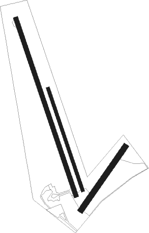
Kerikeri
Airport details
| Country | New Zealand |
| State | Northland |
| Region | NZ |
| Municipality | Bay of Islands-Whangaroa Community |
| Elevation | 491ft (150m) |
| Timezone | GMT +12 |
| Coordinates | -35.26278, 173.91194 |
| Magnetic var | |
| Type | land |
| Available since | X-Plane v10.40 |
| ICAO code | NZKK |
| IATA code | KKE |
| FAA code | n/a |
Communication
| Kerikeri CHRISTCHURCH FSS | 124.100 |
| Kerikeri KERIKERI Ground Control | 128.690 |
| Kerikeri KERIKERI Tower | 122.100 |
Nearby Points of Interest:
Waitangi Treaty Monument
-Mangungu Mission House
Nearby beacons
| code | identifier | dist | bearing | frequency |
|---|---|---|---|---|
| KK | KERIKERI NDB | 0 | 312° | 226 |
| KT | KAITAIA NDB | 35.7 | 289° | 238 |
| WR | WHANGAREI NDB | 37.6 | 139° | 326 |
| SF | SPRINGFIELD (WHANGAREI) NDB | 43.2 | 144° | 366 |
Departure and arrival routes
| Transition altitude | 13000ft |
| Transition level | 15000ft |
| SID end points | distance | outbound heading | |
|---|---|---|---|
| RW15 | |||
| PAKAR2 | 79mi | 153° | |
| UKAP2A | 64mi | 162° | |
| LAKE2 | 16mi | 289° | |
| RW33 | |||
| UKAP1B | 64mi | 162° | |
| WAIHU2 | 16mi | 289° | |
Instrument approach procedures
| runway | airway (heading) | route (dist, bearing) |
|---|---|---|
| RW15 | OTAHA (163°) | OTAHA 3720ft |
| RNAV | OTAHA 3720ft FF15 (5mi, 163°) 2120ft MA15 (5mi, 163°) 688ft OPARE (11mi, 163°) 3400ft | |
| RW33 | OPARE (342°) | OPARE 3550ft |
| RNAV | OPARE 3550ft FF33 (5mi, 343°) 2050ft MA33 (5mi, 343°) 696ft OTAHA (11mi, 343°) 2600ft |
Disclaimer
The information on this website is not for real aviation. Use this data with the X-Plane flight simulator only! Data taken with kind consent from X-Plane 12 source code and data files. Content is subject to change without notice.

