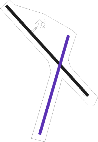
Kaitaia
Airport details
| Country | New Zealand |
| State | Northland |
| Region | NZ |
| Municipality | Te Hiku Community |
| Elevation | 270ft (82m) |
| Timezone | GMT +12 |
| Coordinates | -35.07000, 173.28528 |
| Magnetic var | |
| Type | land |
| Available since | X-Plane v10.40 |
| ICAO code | NZKT |
| IATA code | KAT |
| FAA code | n/a |
Communication
| Kaitaia CTAF | 119.100 |
| Kaitaia CHRISTCHURCH FIS | 127.100 |
Nearby Points of Interest:
Mangungu Mission House
Nearby beacons
| code | identifier | dist | bearing | frequency |
|---|---|---|---|---|
| KT | KAITAIA NDB | 3.2 | 314° | 238 |
| KK | KERIKERI NDB | 32.8 | 107° | 226 |
Departure and arrival routes
| Transition altitude | 13000ft |
| Transition level | 15000ft |
| SID end points | distance | outbound heading | |
|---|---|---|---|
| RW12 | |||
| VALEY2 | 17mi | 105° | |
| BROA2B | 27mi | 127° | |
| STAR starting points | distance | inbound heading | |
|---|---|---|---|
| RW30 | |||
| ARR30 | 10.6 | 286° | |
Instrument approach procedures
| runway | airway (heading) | route (dist, bearing) |
|---|---|---|
| RW12 | STEED (137°) | STEED 2000ft |
| RNAV | STEED 3775ft FF12 (5mi, 137°) 2180ft MA12 (5mi, 137°) 592ft (8672mi, 281°) 770ft STEED (8678mi, 101°) 2000ft STEED (turn) | |
| RW30 | PERIA (286°) | PERIA 3600ft |
| RNAV | PERIA 3745ft FF30 (7mi, 276°) 1515ft MA30 (3mi, 302°) 563ft (8670mi, 281°) 770ft PERIA (8669mi, 101°) 3600ft PERIA (turn) |
Holding patterns
| STAR name | hold at | type | turn | heading* | altitude | leg | speed limit |
|---|---|---|---|---|---|---|---|
| ARR12 | STEED | VHF | right | 304 (124)° | 2000ft - 60000ft | DME 4.0mi | ICAO rules |
| ARR30 | PERIA | VHF | right | 79 (259)° | 3600ft - 60000ft | DME 4.0mi | ICAO rules |
| *) magnetic outbound (inbound) holding course | |||||||
Disclaimer
The information on this website is not for real aviation. Use this data with the X-Plane flight simulator only! Data taken with kind consent from X-Plane 12 source code and data files. Content is subject to change without notice.

